
The Atomic Legacy Cabin is located on Legacy Way behind the Orchard Mesa Municipal Cemetery on 26¼ Road and U.S. Highway 50.
History
In 1943, U.S. Army Corps of Engineers Second Lieutenant Philip C. Leahy met with Lieutenant Colonel Thomas T. Crenshaw, who was in charge of buying uranium for the Manhattan Project. Leahy was told to pack his bags and board a train for a new assignment. It wasn't until he exited the train that he learned of the destination of this new project: Grand Junction, Colorado.
Leahy was charged with getting as much uranium as possible from the Colorado Plateau to support the Manhattan Project. He began by purchasing a 55-acre crescent of land tucked behind Grand Junction’s municipal cemeteries. Formerly a gravel pit, the site was quickly converted to a uranium refinery.
By 1946, the Colorado Plateau had provided more than 2.6 million pounds of uranium oxide, which was approximately 14 percent of the total uranium acquired for the Manhattan Project. After World War II, the U.S. Atomic Energy Commission moved into the Grand Junction site and it became the epicenter of the Cold War uranium boom.
For more on site history and historic photos of the mill, visit the Historic Sites webpage.
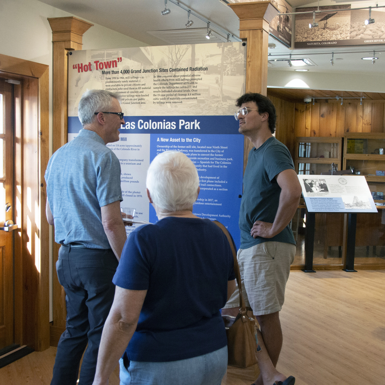
Visitors inside the Atomic Legacy Cabin.
Great Place to Visit - For People and Wildlife!
The Atomic Legacy Cabin interpretive center tells the history of uranium mining and processing on the Colorado Plateau, as well as Grand Junction’s unique contribution to the Manhattan Project and the Cold War. As you make your way around the center, you will find visual and interactive exhibits that detail the U.S. Department of Energy’s environmental cleanup and continuing management of legacy sites across the Colorado Plateau. Visit the Atomic Legacy Cabin webpage for public hours.
Native desert, wetlands, riparian woodlands, and the Gunnison River make the area surrounding the Atomic Legacy Cabin a good home for wildlife, including mule deer, red fox, coyote, red-tailed hawks, bald eagles, osprey, songbirds, Canada geese, mallard ducks, and sometimes wood ducks.
The site is also listed on the National Register of Historic Places for its historic role in the Manhattan Project and the Cold War. The Atomic Legacy Cabin and surrounding property belong to the Riverview Technology Corporation. The Riverview Technology Corporation is a local nonprofit formed by the city of Grand Junction and Mesa County for the purpose of economic development and job retention and creation.
Learn more:https://www.energy.gov/lm/grand-junction-colorado-site
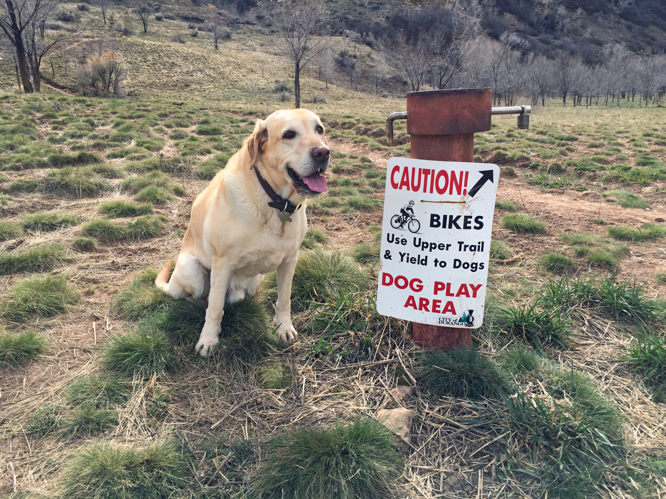
The Durango dog park offers fun for both humans and animals.
The Durango Off Leash Area is located across the river from downtown Durango. Parking is available at Schneider Park on Roosa Avenue. Access the Durango Off Leash Area from Schneider Park by using the Highway 160 underpath. For more information go to the city of Durango website.
History
During World War II, the U.S. Vanadium Corporation operated a uranium mill built on the site of an old lead smelter. The mill reprocessed vanadium tailings for the recovery of uranium for sale to the Manhattan Project from 1943 to 1946. Operations restarted in 1949 and uranium was sold to the U.S. Atomic Energy Commission for national defense purposes until 1963, when it was shut down permanently. Approximately 1.2 million cubic yards of radioactive mill tailings resulted from the milling operations.
From 1986 to 1991, the U.S. Department of Energy removed mill tailings and other contaminated materials from the site and from private and municipal properties or residences where mill tailings were used as fill material and as an additive to concrete and mortar. The contaminated materials were placed in a disposal facility in Bodo Canyon, located 3.5 miles southwest of Durango. The disposal site was officially closed in 1996.
For more on site history and historic photos of the mill, visit the Historic Sites webpage.
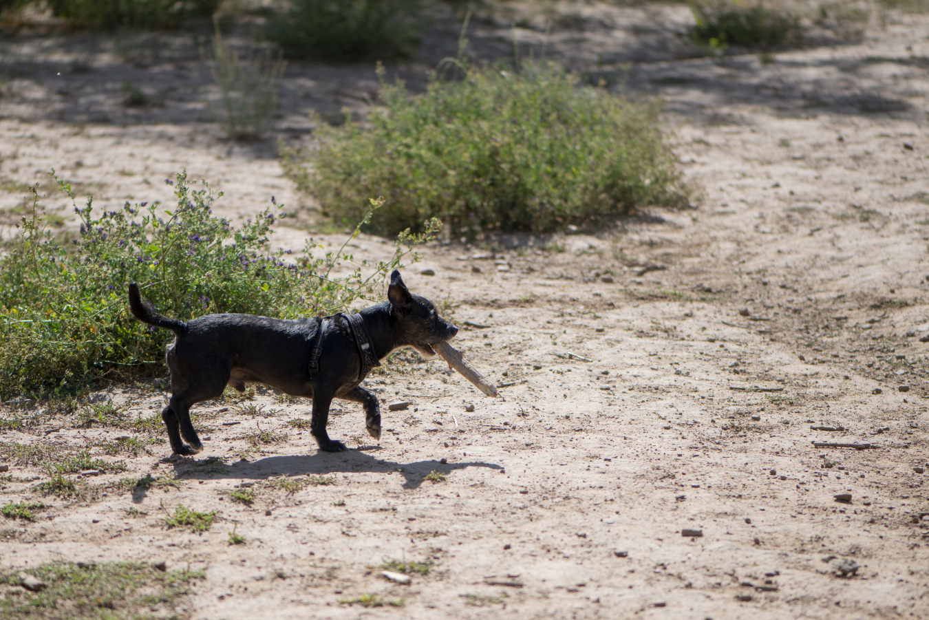
The Durango Off-leash area is a great place to play fetch.
Happy Trails and Wagging Tails
Today you can visit the former processing site and take a walk along the natural-surface trail and watch happy pets run freely and splash around shallow areas of the Animas River. It is open to the public as the city of Durango’s only off-leash area — a dog-friendly park and recreation area owned by the city. Across the river from the park, wayside signs along the river path describe the history of the site.
Geology
Terrace and alluvial gravels exposed in the downtown area of Durango across the Animas River from the site were deposited as outwash gravel from several glacier advances southward from the San Juan Mountains during Pleistocene time.
The Durango processing site sits above the Animas River just below the confluence with Lightner Creek, which comes in from the west. It sits at the east edge of the Colorado Plateau and the north edge of the San Juan Basin. Bedrock in the site area is of Late Cretaceous age. Bedrock beneath the site is the upper part of the Mancos Shale. Exposed above the Mancos farther up the steep slope of Smelter Mountain to the south are the Point Lookout Sandstone and Menefee Formation, which comprise the lower two formations in the Mesaverde Group.
Learn more:https://www.energy.gov/lm/durango-colorado-disposal-and-processing-sites
The Gunnison, Colorado, Processing Site is a former uranium ore processing site on a 61.5-acre tract of land adjacent to the Gunnison County airport, one-half mile southwest of the city of Gunnison.
History
The Gunnison Mining Company built the uranium mill in 1954, three years after uranium was discovered, southeast of Gunnison. The mill processed approximately 540,000 tons of uranium ore between 1958 and 1962. Radioactive mill tailings covered approximately 39 acres at the mill site.
From 1992 to 1995, tailings and other contaminated materials were removed from the Gunnison processing site and contaminated area properties, and transported to, and stabilized in, a 29-acre disposal cell 6 miles east of Gunnison. The U.S. Department of Energy completed construction of the disposal cell in 1995.
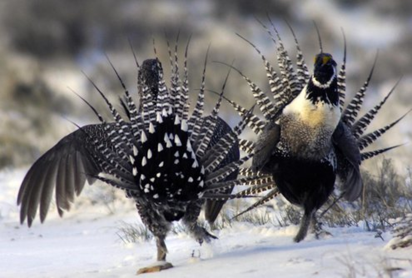
Gunnison sage-grouse in courtship ritual.
Nothing to Grouse About, There Are Grouse About
The Gunnison disposal site is home to the Gunnison sage-grouse. Native to the Colorado Plateau, they only live in a small area of southwestern Colorado and eastern Utah. They are relatively large, dark-brown birds with black bellies and long, pointed tail feathers. They live mostly among big sagebrush. They also require healthy wetland and riparian systems nearby. These provide sources of fresh water, insects, and soft forbs. Forbs are non-woody, soft plants that are an important source of food for the grouse.
Gunnison sage-grouse are known for their elaborate courtship rituals. Every year between mid-March and late May, they gather on areas called leks to breed. Leks are typically open areas within stands of sagebrush with good visibility and qualities that make it easy for sage-grouse to see and hear each other. During mating season, males display specialized feathers on their necks, and yellow-green patches of bare skin on their breasts. The colorful males conduct elaborate displays to attract female birds.
After mating, hens will create a nest on the ground under live sagebrush away from the lek, generally 3 to 4 miles away, and lay six to 10 eggs. Nesting season begins in mid-April and continues into July. Chicks are hatched in an advanced state and can feed themselves almost immediately. They leave the nest with the hen shortly after hatching.
The Gunnison sage-grouse is in danger of disappearing and it is listed as threatened under the Endangered Species Act. Land development, oil and gas drilling, grazing, environmental events, and predators have all taken a toll on the Gunnison sage-grouse. Major predators for adult Gunnison sage-grouse include golden eagles, red foxes, and bobcats. Juveniles are also preyed upon by ravens, badgers, coyotes, and weasels. Nest predators can include crows, magpies, elk, and domestic cows.
Only seven isolated populations of the bird are currently known to exist, and all seven are in decline.
The U.S. Department of Energy has helped protect the sage-grouse by avoiding travel to the Gunnison disposal site during the mating, nesting, and fledging seasons. The Department has also installed special plastic flags on the barbed-wire fence surrounding the site, which help make the fence wires more visible to sage-grouse, so they do not fly into them and become injured or die.
Learn more:https://www.energy.gov/lm/gunnison-colorado-disposal-and-processing-sites
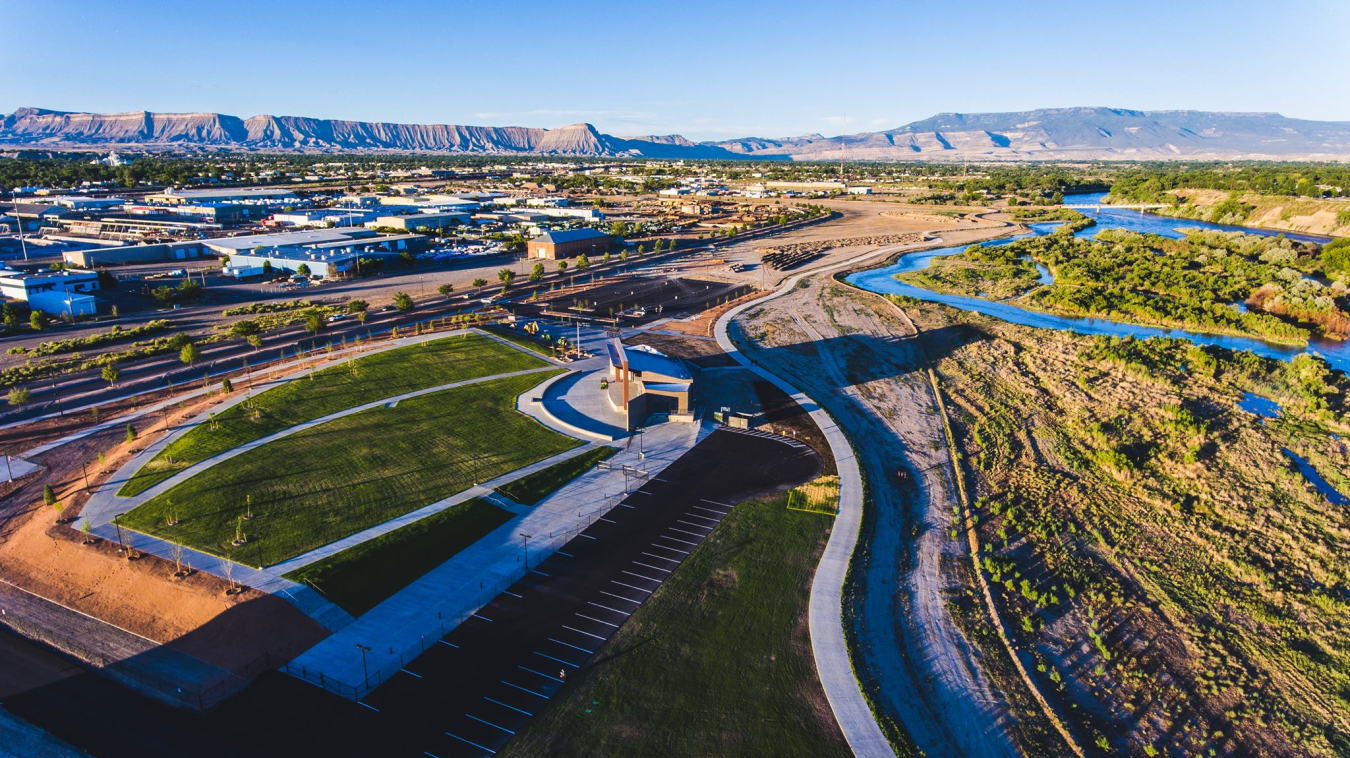
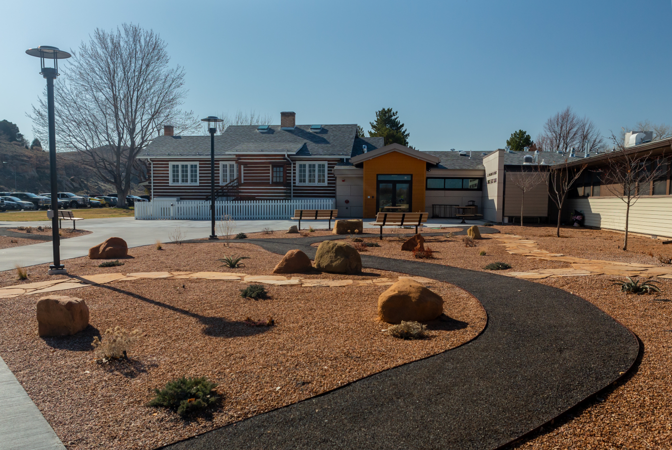
The 130-acre Las Colonias Park is located just south of downtown Grand Junction, between Riverside Parkway and the Colorado River.
History
In 1899 the first sugar beet factory in Colorado was built at the site. It processed beets into sugar.
In 1950, the Climax Uranium Company transformed the site to operate as a uranium and vanadium mill until 1970. During 19 years of operation, the mill produced 2.2 million tons of radioactive tailings.
From 1950 to 1966, mill tailings were available to private citizens and contractors, who used them as fill material and in concrete and mortar. An estimated 300,000 tons of radioactive tailings were hauled to more than 4,000 private and commercial properties in the Grand Junction area before Colorado Department of Health studies caused Climax to stop releasing tailings from the site, due to concerns about potential adverse health effects.
The U.S. Department of Energy built a 94-acre disposal cell to contain contaminated materials about 18 miles southeast of Grand Junction, near U.S. Highway 50. Approximately 4.4 million cubic yards of contaminated materials were transported to the disposal cell.
After cleanup, the state of Colorado transferred ownership of the former mill site to the city of Grand Junction in 1997.
The Return of Chubs and Suckers
The location of the former uranium mill site, today’s Las Colonias Park, was chosen because it was next to the Colorado River, which provided a ready source of water for milling activities. The Colorado River remains a special feature of the park today.
Las Colonias Park was planned in compliance with the Upper Colorado River Endangered Fish Recovery Program, which was initiated in 1988 to help bring four species of endangered fish back from the brink of extinction: the humpback chub, bonytail chub, Colorado pikeminnow, and razorback sucker. The purpose of the program — to achieve natural, self-sustaining populations of the endangered fish so they no longer require protection under the federal Endangered Species Act — is ongoing.
Learn more:https://www.energy.gov/lm/grand-junction-colorado-disposal-and-processing-sites
Las Colonias Park
Located along the riverfront, Las Colonias Park is owned by the City of Grand Junction and offers a wealth of amenities and fun things to do, including biking, fishing, kayaking, picnicking, concerts, and more!
For more information go to the City of Grand Junction website.
The Maybell disposal site is located in Moffat County in northwest Colorado. The town of Maybell is about 5 miles southwest of the site.
History
Union Carbide Corporation began milling uranium at the site in 1957. Uranium ore for the mill came from nearby open-pit mines. During its seven years of operation, the mill processed about 2.6 million tons of ore
The U.S. Department of Energy began cleaning up the site in 1995. All contaminated materials were placed in a disposal cell constructed onsite and the cleanup was completed in 1998.
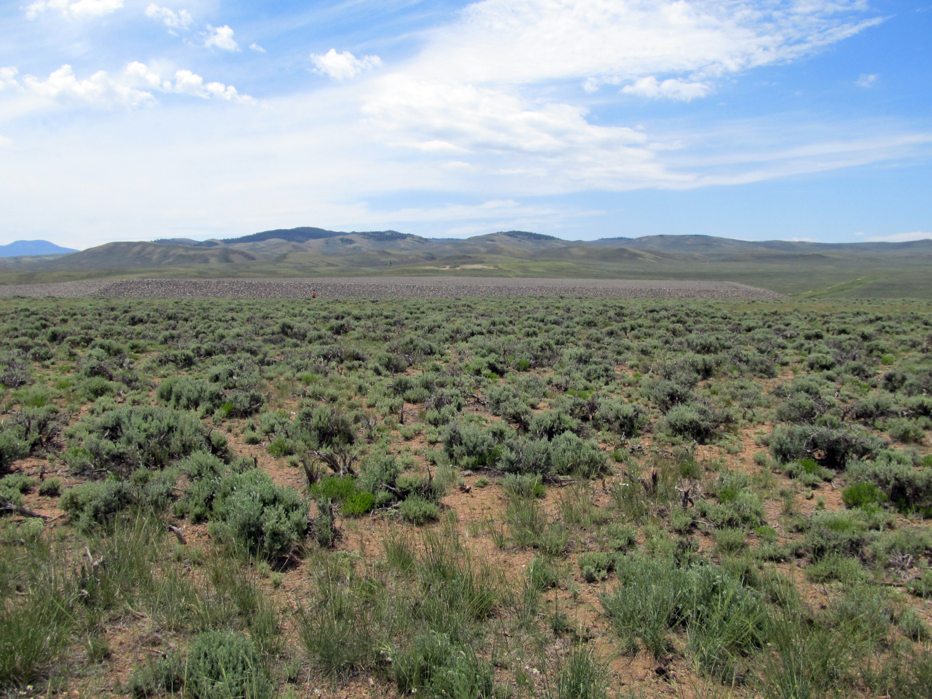
Step Out Into The Steppe
The Maybell disposal site is located in the most widespread ecosystem type of the United States: the sagebrush-steppe ecosystem. To the casual eye, this ecosystem appears to be a monotonous expanse of sagebrush that is devoid of life. In reality, it is teeming with wildlife and contains important natural resources, such as uranium ore, coal, oil, and gas. Pygmy rabbits, sagebrush voles, sagebrush lizards, golden eagles, pronghorns, mule deer, and elk all rely on sagebrush-steppe. While the diversity of wildlife in sagebrush-steppe ecosystems may be less than other ecotypes, such as forests, many species found in sagebrush live nowhere else in the world, such as the greater sage-grouse.
The U.S. Department of Energy promotes the growth of native vegetation at the site, which provides a suitable habitat for greater sage-grouse. The Department also follows pollinator-friendly practices that promote the health of bees, butterflies, birds, and bats.
Geology
At the north edge of the Colorado Plateau, the Maybell disposal site is underlain by bedrock of the Browns Park Formation of Miocene age. This soft, semi-consolidated rock hosts the uranium deposits in the area and consists of sandstone, conglomerate, tuffaceous sandstone, and siltstone.
Learn more:https://www.energy.gov/lm/maybell-colorado-disposal-site
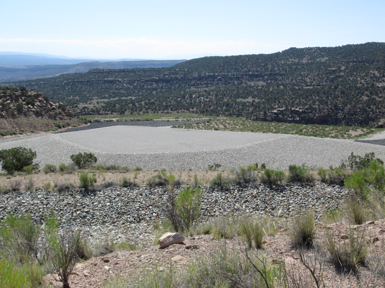
The disposal site is located 15 miles northwest of Naturita, Colorado, totals 27 acres, and contains the Naturita disposal cell.
History
Between 1993 and 1997, the U.S. Department of Energy removed approximately 793,000 cubic yards of contaminated soil and other contaminated materials from the Naturita processing site and adjacent properties. The contaminated materials were contained in an engineered disposal cell at the Naturita disposal site.
Controlling Noxious Alien Weeds
When the U.S. Department of Energy built the disposal site, about 25 acres of land were disturbed by construction activities. All areas surrounding the rock-covered disposal cell had to be revegetated. Ecologists from DOE first visited the site in the early 2000s, several years after revegetation had been completed, and noticed that numerous unwanted, or harmful, weeds were present among the species that were seeded at the site. Invasion by annual weeds is common when lands are disturbed and revegetated, because they are more competitive in barren areas than native species. These weedy plants are considered “early successional” species.
This alien, noxious weed species, known as “saltlover” or “halogeton,” can kill sheep and was found on the Naturita disposal site before ecologists controlled it with a specialized herbicide.
Over time, desirable native species will typically out-compete weedy ones because they are adapted to living in the desert over the long-term; these species are considered “mid- or late-successional” species. This natural process of plant succession, however, does not occur when the early successional species are “alien” to the area and have no natural competitors. These weeds are considered “noxious,” and they often take over the landscape. They decrease the value of the habitat they replace and are commonly toxic to humans, livestock, or wildlife. This was the situation at the disposal site in the early 2000s.
The only reliable control for large infestations of noxious weeds is by herbicide. Ecologists began annually treating the weeds at the disposal site with specialized herbicides, formulated to target the weeds and not harm desirable plants. Today, a noxious weed is rarely found on the site, and natural plant succession can take place.
Geology
Thirteen miles to the northwest of the Naturita processing site, the Naturita disposal site just west of Uravan is on Club Mesa, a bench formed on sandstone of the Salt Wash Member of the Morrison Formation of Late Jurassic age.
The site is in the center of the Uravan Mineral Belt, which is about 50 miles long and 5 miles wide in southwestern Colorado. The mineral belt is defined where uranium and vanadium deposits in the Salt Wash Member of the Morrison Formation have a closer spacing, larger size, and higher grades than adjoining areas. Sandstones in the salt wash were deposited by stream channels and vanadium and uranium were concentrated in a chemically reducing environment.
Learn more:https://www.energy.gov/lm/naturita-colorado-disposal-and-processing-sites
The Naturita processing site is a former uranium and vanadium mill in western Colorado, about 2 miles northwest of the city of Naturita in Montrose County, Colorado. The approximately 79-acre processing site is bounded by the San Miguel River on the east and State Highway 141 on the west.
History
The Vanadium Corporation of America (VCA) periodically milled for vanadium and uranium at the site between1939 and 1958. VCA established a company town nearby for workers to live at. The company named the “Vancorum,” formed from the first letters of the words Vanadium Corporation of America.
The mill processed approximately 704,000 tons of ore and produced a pile of radioactive tailings that covered about 24 acres of the processing site. An additional 126 acres of soil on the processing site and adjacent properties were contaminated from ore storage and windblown tailings. The tailings pile was purchased in 1976 and moved off-site by 1979 for reprocessing to extract additional uranium and vanadium.
Today, the U.S. Department of Energy samples groundwater and the San Miguel River annually and monitors the effectiveness of controls, ensuring continued protection of human health and the environment.
For more on site history and historic photos of the mill, visit the Historic Sites webpage.
San Miguel River
Like other uranium and vanadium mills, the Naturita mill needed a large supply of water to process the ores; it used water from the adjacent San Miguel River.
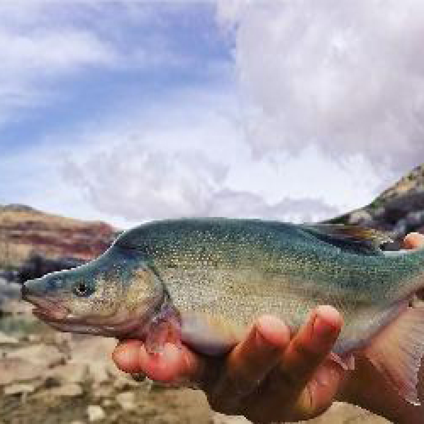
The San Miguel River is one of the last relatively free-flowing rivers in the state and is renowned for its whitewater boating and prized trout fishing. It is also home to three native fish — roundtail chub, bluehead sucker, and flannelmouth sucker — that are now considered “sensitive species.” A short time ago, their populations were trending towards extinction until a historic April 2015 court decision protected them. This is their story.
Since the late 1800s, water use in Colorado was governed by water rights laws that were founded on the concept of “first in time, first in right.” Farmers, mining companies, and other industries could take for their own use certain amounts of water from streams if they were the first entity to divert and beneficially use the water. Over time, so many entities were diverting the water in the San Miguel River that, at times, it would nearly run dry. The idea of maintaining water flows in a stream for environmental purposes, in this case, for keeping three native fish alive, was not legally possible. This changed in the early 2000s when environmental agencies and advocates became involved. They promoted the concept and need for “instream flow rights.”
In 2002, the Colorado Water Conservation Board (CWCB) was authorized to acquire water rights in instances where the natural environment needed to be preserved or improved, such as when instream flows needed to be preserved. This allowed the CWCB to acquire a senior water right to maintain minimum flows in the San Miguel River to protect the three fish. The decision was contested, but it was upheld by the Colorado Supreme Court.
Geology
The Naturita processing site is in the northeast part of the Colorado Plateau and in the Paradox Basin, which is bounded by the Uncompahgre Uplift nearby to the northeast. The Paradox Basin formed during Pennsylvanian time and was the site of thick salt and evaporite deposits.
Bedrock exposed just above the San Miguel River floodplain, where the alluvium is about 20 feet thick, is siltstone and claystone of Late Jurassic age. Tan sandstone cliffs several hundred feet above the valley floor comprise the Burro Canyon Formation of Early Cretaceous age. Dakota Sandstone of Late Cretaceous age overlies the Burro Canyon and consists of thin gray sandstone, siltstone, and coal, which was mined in the area (one small mine can be seen along the east skyline).
Learn more:https://www.energy.gov/lm/naturita-colorado-disposal-and-processing-sites
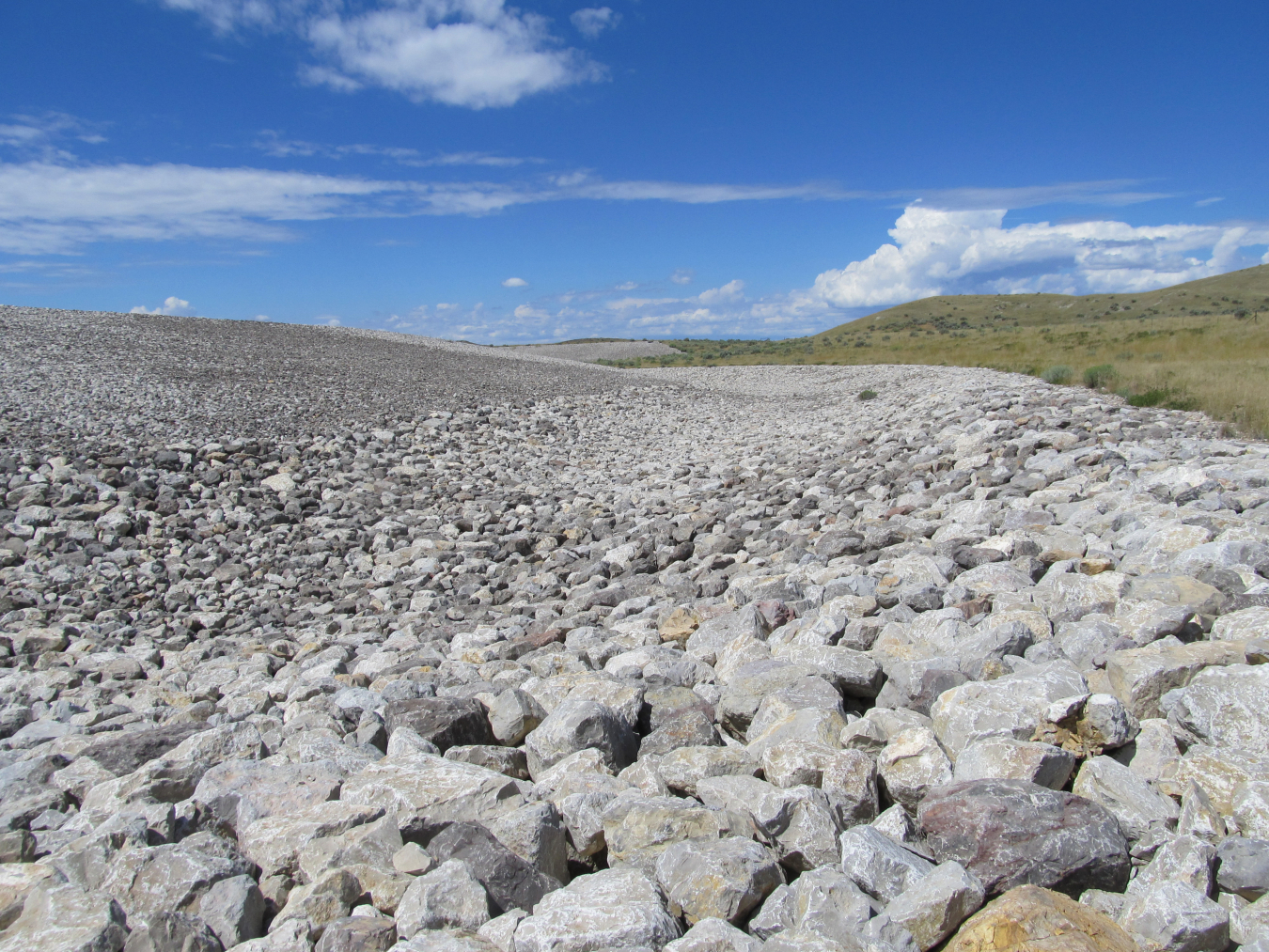
The Rifle disposal site sits on 205 acres in Estes Gulch, about 6 miles north of the city of Rifle.
History
In August 1991, the U.S. Bureau of Land Management permanently transferred administration of 205 acres in Estes Gulch to the U.S. Department of Energy for use as the Rifle disposal site. Tailings and contaminated materials from both former mill sites were relocated to the disposal site. About 3.5 million cubic yards of contaminated materials are contained in the cell.
The Rifle disposal cell measures approximately 3,000 feet on each side. The cover encompasses an area of 71 acres on the 205-acre site.
Geology
Bedrock beneath the Rifle disposal site is multicolored mudstone, siltstone, and sparse sandstone of the Wasatch Formation of Paleocene to Eocene age. These rocks dip steeply to the southwest off the flank of the nearby Grand Hogback, which forms the boundary of the Colorado Plateau and the Southern Rocky Mountains.
Learn more:https://www.energy.gov/lm/rifle-colorado-disposal-site-and-processing-sites
Two former uranium and vanadium processing sites are located near the city of Rifle, Colorado.
The Old Rifle site is approximately 0.3 mile east of the city of Rifle. The New Rifle site is approximately 2 miles southwest of Rifle.
The New Rifle site is approximately 2 miles southwest of the city center. As part of the cleanup for this site, the U.S. Department of Energy was required to replace 34.2 acres of wetland that had been disturbed by milling and remediation activities. Today, the wetland provides habitat for thousands of aquatic and terrestrial plants and animals.
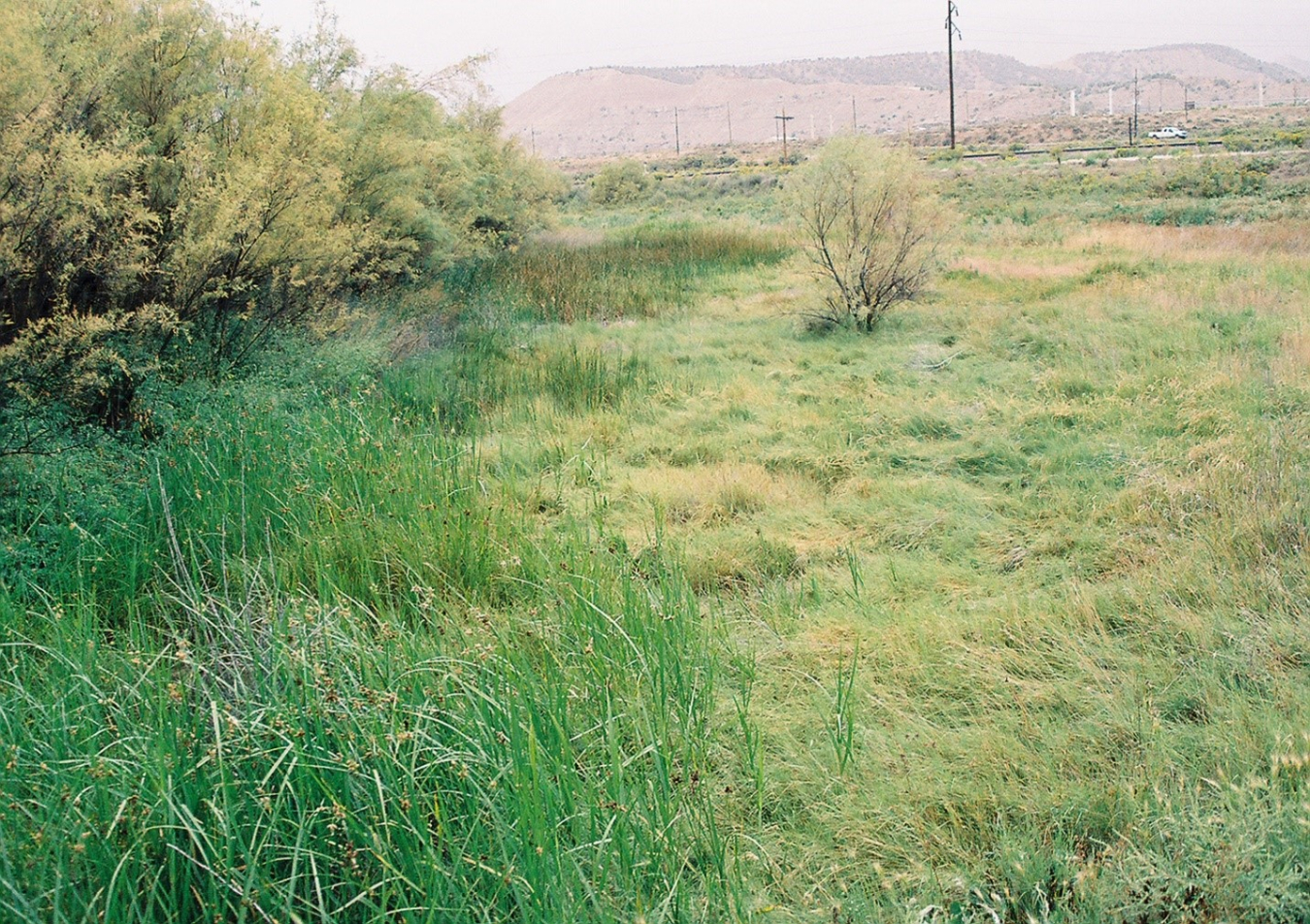
Wetlands at the New Rifle processing site in Rifle, Colorado.
History
The U.S. Vanadium Company operated two mills in Rifle, Colorado. The Old Rifle mill operated from 1924 to 1932 and from 1942 to 1958. It processed vanadium and uranium. Ore was shipped to the mill by truck and rail from eastern Utah and from mines located near Meeker and Rifle, Colorado. After 1958, most of the mill tailings at the Old Rifle site were reprocessed and deposited at the New Rifle site.
The New Rifle mill replaced the Old Rifle mill in 1958. The mill was constructed as part of a multisite complex that included the upgrading facilities at Slick Rock, Colorado, and Green River, Utah. Ore and upgrade products from those sites were shipped to the New Rifle mill by truck and rail. From 1958 to 1973, the mill produced uranium and vanadium concentrates. The New Rifle mill processed tailings from the Old Rifle mill, processed uranium ore, and refined upgrade products. From 1973 to 1984, part of the mill was used to produce vanadium concentrate, which did not produce tailings.
Wetlands — Nursuries of Life
The U.S. Department of Energy completed remediation of the New Rifle processing site in 1996. As part of the cleanup, DOE was required to replace 34.2 acres of wetland that had been disturbed by milling and remediation activities. It was important to replace the wetland because they are considered “nurseries of life.” They provide habitat for thousands of species of aquatic and terrestrial plants and animals. Migrating birds use wetlands to rest and feed during their cross-country journeys and as nesting sites when they are at home. Without wetlands, many species of plants and animals would become extinct. Wetlands also help absorb and slow floodwaters. This ability to control floods can save properties from being damaged and even save lives.
DOE worked for years trying to successfully restore the Rifle wetlands. Biologists reseeded some areas on several occasions, replaced soils in other areas, treated unwanted, or harmful, weed species every year, and monitored the success of these efforts. In January 2011, it was determined that DOE had successfully restored its 34.2 acres. Today, the site looks as if milling and remediation had never taken place.
Geology
Two Rifle processing sites about 2 miles apart (New Rifle site to the west and Old Rifle site to the east) are on sand and gravel deposits of the floodplain just north of the Colorado River. At both sites, bedrock below the floodplain deposits is the multicolored mudstone, siltstone, and sparse sandstone of the Shire Member of the Wasatch Formation Early Tertiary age. The setting for both sites is in the northeast part of the Colorado Plateau.
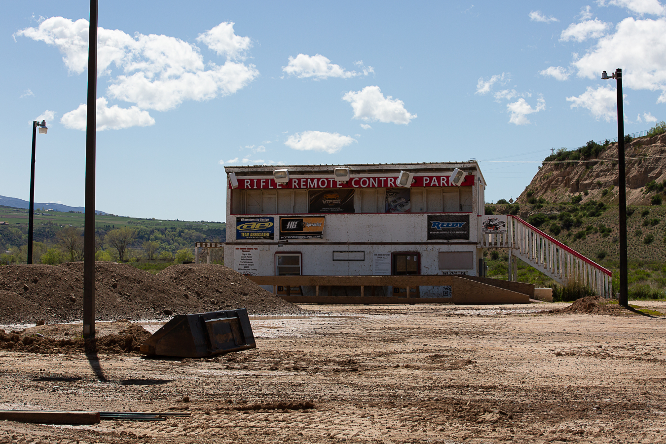
Rifle Remote Control Park
The Old Rifle site is now City owned-property where many remote control enthusiasts come to race at the 120 feet by 200 feet Rifle Remote Control Car Park.
Learn more:https://www.energy.gov/lm/rifle-colorado-disposal-site-and-processing-sites
The Slick Rock processing sites consist of two former uranium and vanadium ore-processing facilities located in a remote area of southwest Colorado about 22 miles north of the town of Dove Creek in San Miguel County. These sites, referred to as Slick Rock East and Slick Rock West, are about 1 mile apart and are adjacent to the Dolores River. The Slick Rock disposal site is in a remote area about 5 miles east of the processing sites.
History
The Shattuck Chemical Company constructed the Slick Rock East mill in 1931. In 1934, North Continent Mines, Inc., acquired the facility. The mill was designed to extract radium salts and vanadium from locally mined ores. In 1945, the federal government acquired control of the facility to supply uranium for the Manhattan Project. Union Carbide Corporation became the owner of the facility in 1957, and the mill closed in the early 1960s. Milling operations created radioactive tailings.
Union Carbide’s mill at Slick Rock West began operation in 1957 using a uranium-vanadium upgrading technique to process ore mined from the surrounding area. The upgraded material was shipped to the Union Carbide mill at Rifle, Colorado, for further processing. The Slick Rock West mill closed in 1961.
In 1995, tailings and other contaminated materials were relocated to the Slick Rock disposal site, also known as the Burro Canyon disposal cell, about 5 miles east of the processing sites. About 129,000 cubic yards of materials came from the Slick Rock East mill site and about 671,000 cubic yards of these contaminated materials came from the Slick Rock West mill site. The disposal cell contains 1.14 million dry tons of contaminated materials.
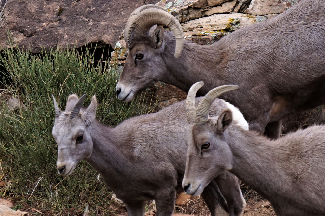
Desert bighorn sheep.
Return of the Bighorn
Both of the former Slick Rock mill sites, now known as “processing sites,” were located in the Dolores River Canyon, a steep, rugged canyon consisting of rock walls over 1,000 feet high. It’s hard to imagine humans or animals surviving in this landscape. Today, however, desert bighorn sheep thrive within these rock walls.
From the 1500s to the mid-1900s, no bighorn sheep were known to live within Colorado. However, earlier native people likely saw bighorn sheep in the Dolores River Canyon. Rock art created by Ancestral Puebloans commonly includes images of bighorns.
Unlike other hooved animals, who’s offspring disperse to new areas, bighorn sheep pass their knowledge of home ranges and migration routes from one generation to the next. Once bighorn sheep no longer exist in an area, they typically do not return to it on their own. In 1979 and 2001 biologists conducted 12 operations in Colorado to transplant and release 218 desert bighorn sheep from Arizona, Nevada, and Utah. As a result, three herds now live in Colorado, including the one that roams the former Slick Rock mill sites.
Geology
The two Slick Rock processing sites are in the eastern part of the Colorado Plateau and within the southern part of the Uravan Mineral Belt, where uranium and vanadium deposits are closely spaced.
The Slick Rock processing sites are on gravel terraces above and just south of the Dolores River. Bedrock below the terrace gravel at the western site is the Navajo Sandstone of Early Jurassic age and the overlying Entrada Sandstone of Middle Jurassic age. Bedrock below the terrace material at the eastern site is the Salt Wash Member of the Morrison Formation of Late Jurassic age.
Learn more:https://www.energy.gov/lm/slick-rock-colorado-disposal-and-processing-sites
Official websites use .gov
A .gov website belongs to an official government organization in the United States.
Secure .gov websites use HTTPS
A lock (
) or https:// means you’ve safely connected to the .gov website. Share sensitive information only on official, secure websites.