
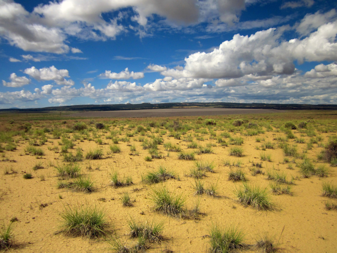
The Ambrosia Lake disposal site is a former uranium-ore processing facility in McKinley County, approximately 25 miles north of Grants, New Mexico.
History
Phillips Petroleum Company built the original mill at the site in 1957 to process ore from nearby mines. United Nuclear Corporation purchased and briefly operated the mill in 1963. The mill processed more than 3 million tons of uranium ore between 1958 and 1963 and provided uranium for U.S. government national defense programs. The original mill was built in 1957 to process ore from nearby mines. In the late 1970s to early 1980s, an ion exchange system operated at the site, extracting uranium from mine water. All mill operations ceased in 1982, leaving radioactive mill tailings on approximately 111 acres. Wind and water erosion spread some of the tailings across a 230-acre area.
The U.S. Department of Energy remediated the site and contaminated area properties between 1987 and 1995 and disposed of all contaminated material onsite in an engineered disposal cell.
The disposal cell was closed in 1995 upon encapsulation of the tailings and completion of the disposal cell cover.

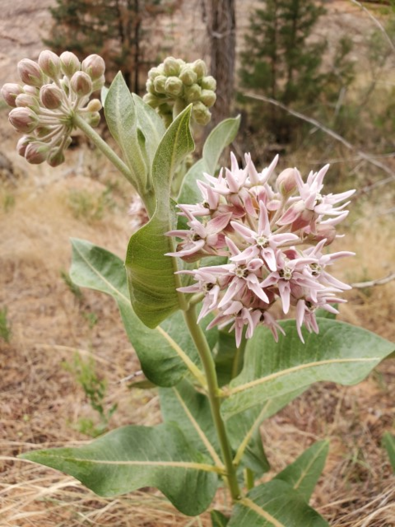
Monarch butterfly
Monarchs and Whorled Milkweed
In 2019, U.S. Department of Energy ecologists noticed naturally growing western whorled milkweed, or horsetail milkweed, growing at the Ambrosia Lake site. This was an important discovery, because monarch butterflies, which depend on milkweed for survival, have been in a significant decline during the last 20 years.
A monarch’s life is amazing and complicated. In early spring each year, monarchs that have been hibernating in Mexico awaken and head north. On the way north, they lay eggs on native milkweed plants. From the egg, a black, yellow, and white-striped caterpillar (larva) is born. It feeds on milkweed plants as it grows to its full length of 2 inches. The caterpillar then forms a protective covering around itself (called a chrysalis, or pupa). After a short time, a new monarch butterfly emerges from the pupa and continues to migrate north. The entire process, from egg to butterfly, takes about a month and is repeated about four times during the northern migration. In August, the fourth generation (the great, great grandchildren), known as the “super generation,” begins the long journey south back to Mexico.
The main goal of the “super generation” of monarchs is to feed on nectar from a variety of late-blooming wildflowers, including milkweeds, and fly to Mexico. They live eight-times longer than their parents and grandparents and fly 10-times farther. DOE’s New Mexico disposal sites support milkweed and other flowering plants that feed the monarchs in the fall and provide egg-laying sites in the spring.
DOE plans to improve and enhance pollinator habitats by promoting the growth of flowering plants at the Ambrosia Lake site.
Geology
The site is in the broad Ambrosia Lake Valley and near the center of the Grants Mineral Belt at an elevation of about 7,000 feet.
The thick Mancos Shale at the surface of the site was deposited in a marine environment in the Late Cretaceous time. This shale is soft, easily eroded, and underlies many of the wide valleys in the Colorado Plateau. Nearby uranium mines in this part of the Grants Mineral Belt are about 500 feet underground. Through these mines, ore is removed from the Westwater Canyon Member of the Morrison Formation of Late Jurassic age.
Learn more: https://www.energy.gov/lm/ambrosia-lake-new-mexico-disposal-site
The Bluewater disposal site is approximately 9 miles northwest of Grants, New Mexico.
History
Anaconda Copper Company constructed two mills at the site. They build the first mill in 1953 to process limestone uranium ore. This mill had a production capacity of 300 tons of ore per day. They build a second mill in 1957 to process sandstone uranium ore from the Jackpile-Paguate mine, the largest open-pit uranium mine in North America, located north of the Laguna Pueblo. In addition to the mills, the company built a small village and golf course on site for workers. In 1977, the Anaconda Copper Company became a subsidiary of the Atlantic Richfield Company (ARCO) and milling operations ended in 1982.
Uranium ore processing at the Bluewater mill produced radioactive tailings. By 1995, all mill tailings, contaminated soils, demolished mill structures and contaminated vicinity property materials were encased in an on-site disposal cell.
All About Forbs
When ecologists inventoried the Bluewater disposal site for rare plant species in 2019, they found many unique forbs but no rare plants. What are forbs? Ecologists use this term to describe plants that are not grasses and not shrubs or trees but are broadleaf, flowering plants. They are often known as wildflowers or weeds. Wildflowers are pretty, desirable forbs, whereas weeds are typically alien and undesirable forbs. One of the benefits of forbs is that many pollinators, including bees and butterflies, are attracted by them. Ecologists have counted many species of forbs at the Bluewater site.
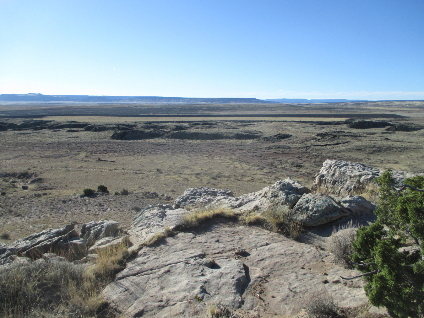
Geology
The site covers 3,300 acres and mostly consists of sedimentary rock outcrops and large areas of wind-deposited, fine-grained materials. About one-third of the site is covered by basalt lava flows that filled a former river valley and covered alluvial sediments that were present in the valley.
Learn more: https://www.energy.gov/lm/bluewater-new-mexico-disposal-site
The L-Bar disposal site is in Cibola County approximately 47 miles west of Albuquerque, New Mexico, and 10 miles north of Laguna Pueblo. The site is located on part of the former L-Bar ranch and is about 3 miles east-southeast of the village of Seboyeta.
History
SOHIO Western Mining Company (SOHIO) conducted mining and milling at this site located on the former L-Bar Ranch from 1977 to 1981, when the mine closed due to a decline in the uranium industry. About 2.1 million tons of ore was processed at the mill. The mill processed about 2.1 million tons of ore. The ore came from the L-Bar mine, the United Nuclear Corporation St. Anthony mine, and the Anaconda Jackpile mine. Surface cleanup was completed in 2000.
The disposal site consists of a 100-acre disposal cell located on a 738-acre parcel. The disposal cell contains about 2.1 million tons of tailings.

Grazing
The L-Bar site has come full circle. Before mining and milling operations began there, it was part of the L-Bar ranch. Today, the U.S. Department of Energy maintains a license with a local rancher for livestock grazing. L-Bar is one of five sites on which DOE currently supports livestock grazing. DOE lands are grazed only when the onsite vegetation is healthy enough to be grazed. Ecologists ensure that grazed sites remain healthy by monitoring vegetation every three years. Grazing agreements are offered to the local rancher at no cost, because DOE receives benefits by having that rancher nearby to maintain fences, monitor for trespassing, and alert DOE of noteworthy occurrences, such as wildfires.
Geology
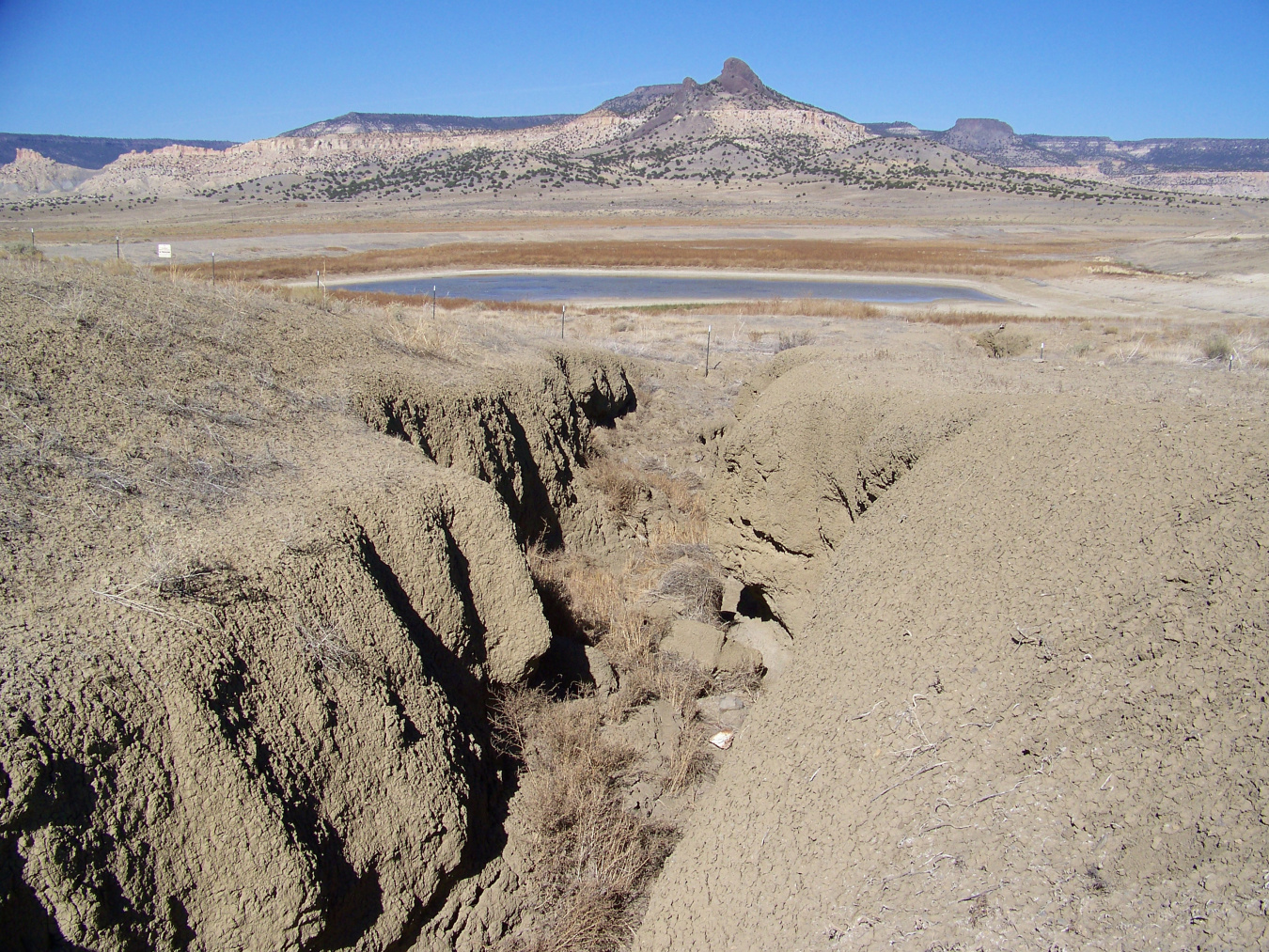
The L-Bar site is near the edge of the southeast part of the Colorado Plateau. Mancos Shale at the surface of the site was deposited in a marine environment in Late Cretaceous age. The shale is gray, soft, and erodes easily during intense heavy rain events when deep gullies can form.
The Mount Taylor volcanic field, which formed in Late Tertiary time, is near the site to the northwest. Cerro Negro, about 1.5 miles to the northwest, is a volcanic neck composed of basalt that has been exposed by erosion and is an expression of the volcanic field.
Beneath the Mancos Shale is a thin layer of Dakota Sandstone, which is underlain by the Morrison Formation of Late Jurassic age. The Brushy Basin Member, the uppermost member of the Morrison Formation, contains the Jackpile Sandstone. This sandstone hosts most of the uranium ore in the Jackpile Mine, about 1 to 3 miles south of the site. The Jackpile Mine was the largest uranium producer in the United States from 1956 to 1960.
Learn more:https://www.energy.gov/lm/l-bar-new-mexico-disposal-site
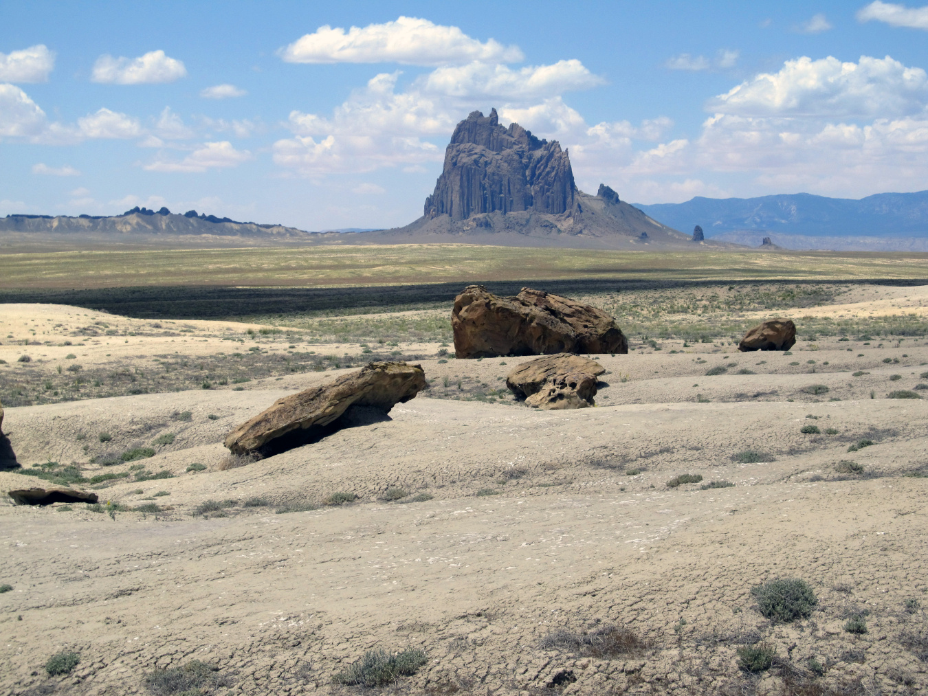
The site is within the Navajo Nation in the northwest corner of New Mexico near the town of Shiprock, approximately 28 miles west of Farmington.
History
Kerr McGee built the mill on land leased from the Navajo Nation and operated the facility from 1954 until 1963. Vanadium Corporation of America (VCA) purchased the it in 1963. VCA and its successor, Foote Mineral Company operated the mill until it closed in 1968. Milling operations created process-related wastes and radioactive tailings. The mill, ore storage area, raffinate ponds (ponds that contain spent liquids from the milling process), and tailings piles occupied approximately 230 acres leased from the Navajo Nation.
In 1983, the U.S. Department of Energy and the Navajo Nation entered into an agreement for site cleanup. By September 1986, all tailings and associated materials (including contaminated materials from offsite area properties that had been contaminated) were encased in the disposal cell built on top of the existing tailings piles.
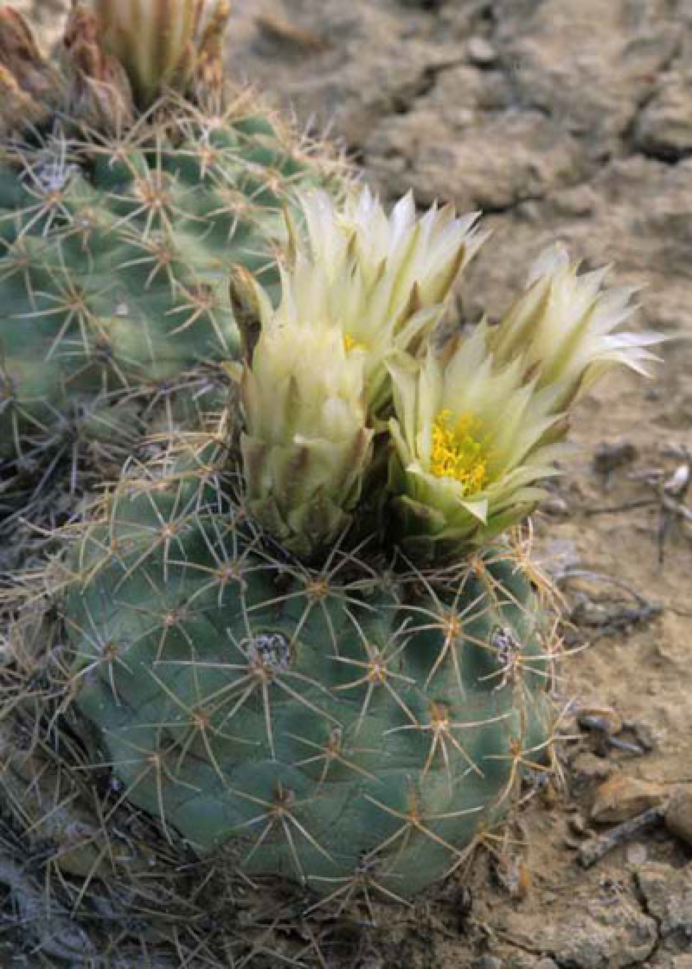
Tiny Cacti
Most of the Shiprock disposal site is composed of a rock-covered disposal cell and the small strips of land that surround it are highly disturbed, containing little vegetation. Just outside the fenced site, however, away from dirt roads and human activity, is a rarely seen species of cactus. In fact, a casual visitor may not notice it if it isn’t in bloom or it hasn’t rained lately. The plants are only 1.5 to 3 inches tall, and they retract into the soil during drought. This unusual plant, called the Mesa Verde cactus, is found only in San Juan County, New Mexico, and Montezuma County, Colorado. There are so few of these plants left that it is considered a threatened species and the state of New Mexico considers it endangered. The cactus is disappearing primarily because of human-related disturbances: off-road vehicle use, urban development, oil and gas development, coal mining, powerline construction, livestock trampling, and environmental events.
The U.S. Department of Energy conducts surveys for this plant before they disturb the ground near the disposal site. If plants are found, they are avoided and protected. Biologists conducted a survey in 2020 near the disposal site and found 127 cacti that were alive. Most of them were discolored and retracted into the soil because of drought. With continued protection, this cactus will hopefully survive for future generations to find.
Learn more:https://www.energy.gov/lm/shiprock-new-mexico-disposal-site
Official websites use .gov
A .gov website belongs to an official government organization in the United States.
Secure .gov websites use HTTPS
A lock (
) or https:// means you’ve safely connected to the .gov website. Share sensitive information only on official, secure websites.