
An official website of the United States government
Here's how you know
Official websites use .gov
A .gov website belongs to an official government organization in the United States.
Secure .gov websites use HTTPS
A lock (
) or https:// means you’ve safely connected to the .gov website. Share sensitive information only on official, secure websites.
Sandy Fire Photos
Photo
Caption
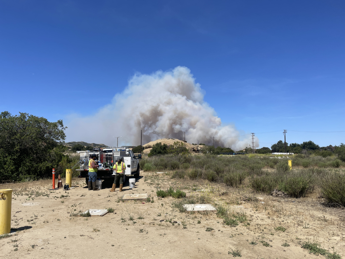
When the Sandy Fire broke out near the Santa Susana Field Laboratory (SSFL) on May 18, 2026, DOE workers immediately began monitoring the situation and prepared to follow safety protocols. The Ventura County Fire Department issued evacuation orders for SSFL, and all DOE personnel were accounted for and safely followed orders. The site remained closed until crews successfully got the blaze under control, keeping it from crossing onto the site.
Credit
Photo credit: Josh Mengers
Photo
Caption
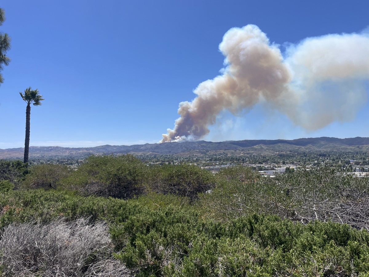
The Sandy Fire smoke plume observed on May 19, 2026, near the Santa Susana Field Laboratory (SSFL), where the DOE previously conducted liquid metals and nuclear energy research at the Energy Technology Engineering Center (ETEC).
Credit
Photo credit: Josh Mengers
Photo
Caption
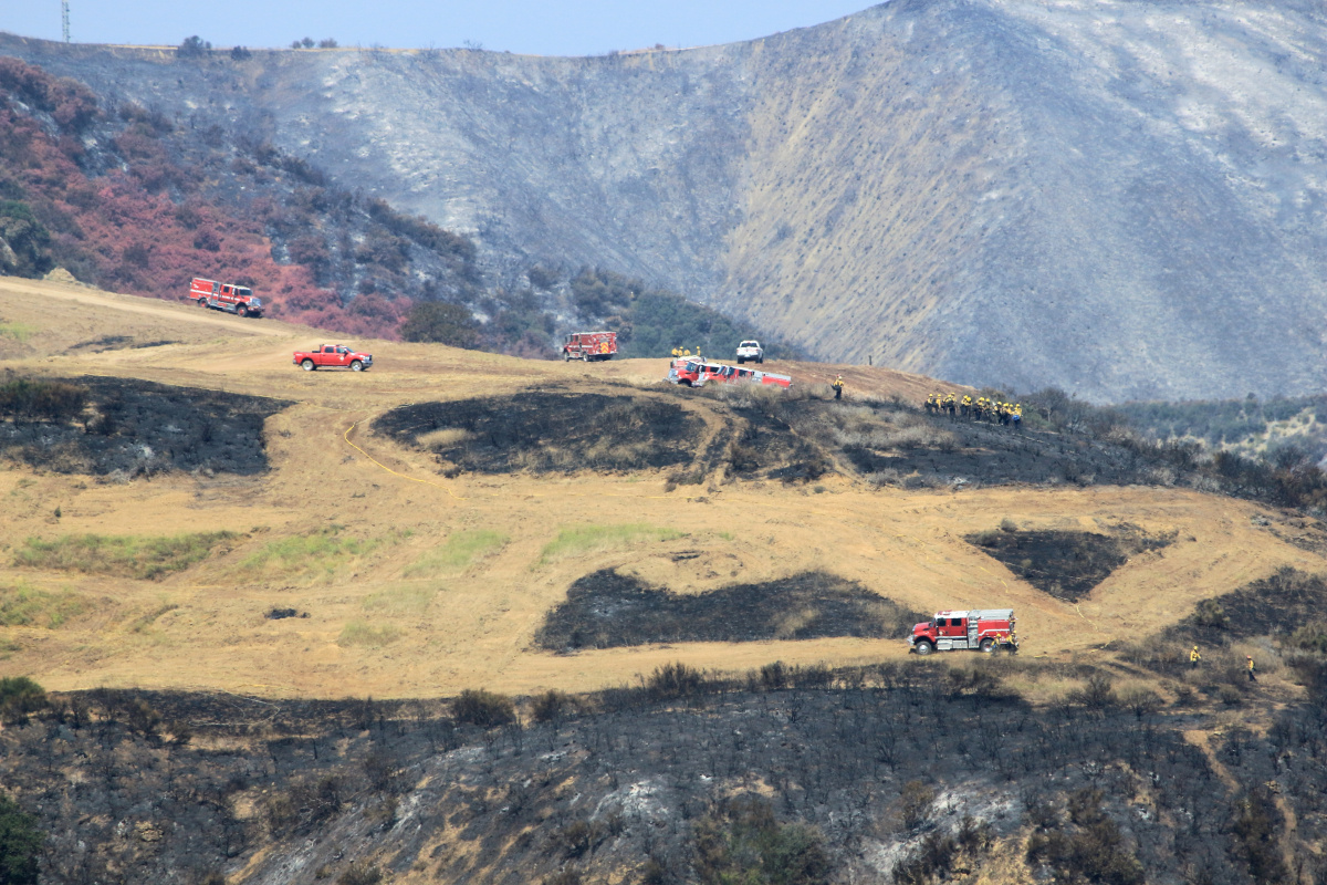
Ventura County Fire Department crews successfully protected not only homes threatened by the Sandy Fire, but also the Santa Susana Field Laboratory, where DOE previously conducted liquid metals and nuclear energy research at the Energy Technology Engineering Center (ETEC) in Area IV. More than 500 firefighters and numerous tankers, engines, helicopters and dozers battled the blaze and kept it from crossing the site's boundary.
Credit
Photo credit: Josh Mengers
Photo
Caption
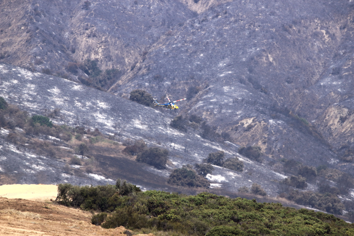
Ventura County fire crews used helicopters for water and fire-retardant drops while battling the Sandy Fire in May 2026.
Credit
Photo credit: Josh Mengers
Photo
Caption
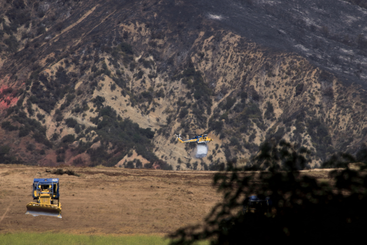
Ventura County fire crews fought the Sandy Fire using not only helicopters for water and fire-retardant drops but also dozers to help create fire breaks.
Credit
Photo credit: Josh Mengers
Photo
Caption
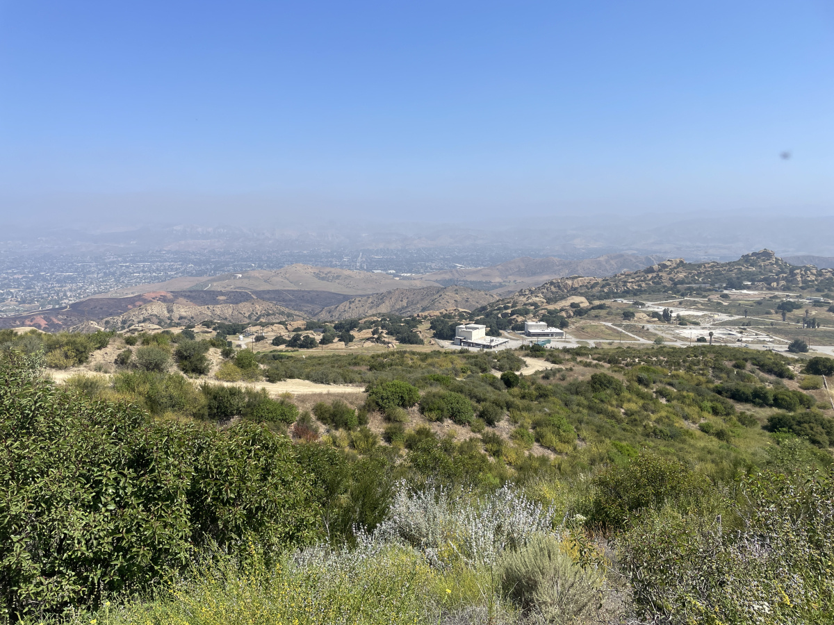
On May 22, 2026, smoke from the Sandy Fire covered the hills behind the Santa Susana Field Laboratory (SSFL) as seen from Area IV, where DOE previously operated the Energy Technology Engineering Center (ETEC).
Credit
Photo credit: Josh Mengers
Photo
Caption
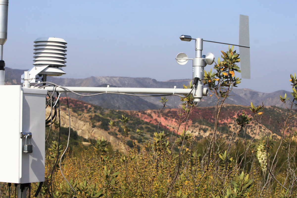
During the Sandy Fire in May 2026, DOE's Radiological Assistance Program (RAP) team partnered with state regulators and local entities to provide radiological air monitoring. RAP established a site baseline of radiological substances in the air using gamma scanners. RAP will identify changes to any radiological substances outside the footprint of the ETEC site. Additionally, DOE's perimeter air monitoring system that has been operating since 2018 continued collecting air quality data from SSFL and the surrounding community.
Credit
Photo credit: Josh Mengers
Photo
Caption
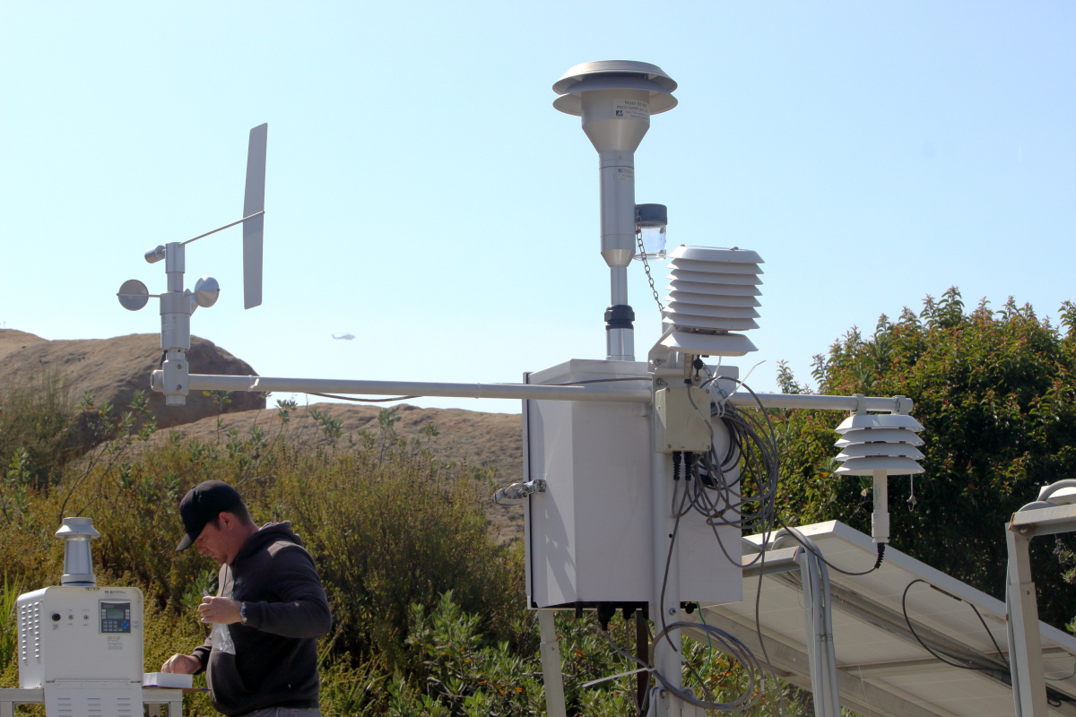
On May 22, 2026, once the Sandy Fire was safely under control and no longer threatening the Santa Susana Field Laboratory (SSFL), some essential staff coordinated access to check on the site and gather the air monitoring data. While onsite, one of DOE's radiological technicians changed out filters in the four perimeter air monitors. As of early June, the data collected is being reviewed and analyzed to determine what impact the Sandy Fire had on SSFL and the nearby communities.
Credit
Photo credit: Josh Mengers
Photo
Caption
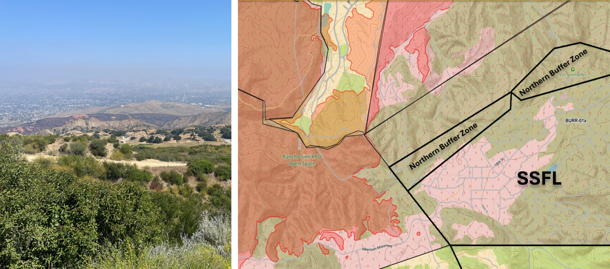
The Sandy Fire broke out on May 18, 2026, and burned near the Santa Susana Field Laboratory (SSFL), but fire crews' rapid response, skill and tireless efforts protected countless homes and successfully contained the fire at 2,183 acres by May 27, 2026, before it crossed onto SSFL. The image on the left shows the burned hills behind SSFL, while the map on the right shows the spread of the Sandy Fire and its proximity to the site.
When the Sandy Fire broke out near the Santa Susana Field Laboratory (SSFL) on May 18, 2026, DOE workers immediately began monitoring the situation and prepared to follow safety protocols. The Ventura County Fire Department issued evacuation orders for SSFL, and all DOE personnel were accounted for and safely followed orders. The site remained closed until crews successfully got the blaze under control, keeping it from crossing onto the site.
Credit
Photo credit: Josh Mengers
When the Sandy Fire broke out near the Santa Susana Field Laboratory (SSFL) on May 18, 2026, DOE workers immediately began monitoring the situation and prepared to follow safety protocols. The Ventura County Fire Department issued evacuation orders for SSFL, and all DOE personnel were accounted for and safely followed orders. The site remained closed until crews successfully got the blaze under control, keeping it from crossing onto the site.
Photo credit: Josh Mengers
Photo
Caption
The Sandy Fire smoke plume observed on May 19, 2026, near the Santa Susana Field Laboratory (SSFL), where the DOE previously conducted liquid metals and nuclear energy research at the Energy Technology Engineering Center (ETEC).
Credit
Photo credit: Josh Mengers
The Sandy Fire smoke plume observed on May 19, 2026, near the Santa Susana Field Laboratory (SSFL), where the DOE previously conducted liquid metals and nuclear energy research at the Energy Technology Engineering Center (ETEC).
Photo credit: Josh Mengers
Photo
Caption
Ventura County Fire Department crews successfully protected not only homes threatened by the Sandy Fire, but also the Santa Susana Field Laboratory, where DOE previously conducted liquid metals and nuclear energy research at the Energy Technology Engineering Center (ETEC) in Area IV. More than 500 firefighters and numerous tankers, engines, helicopters and dozers battled the blaze and kept it from crossing the site's boundary.
Credit
Photo credit: Josh Mengers
Ventura County Fire Department crews successfully protected not only homes threatened by the Sandy Fire, but also the Santa Susana Field Laboratory, where DOE previously conducted liquid metals and nuclear energy research at the Energy Technology Engineering Center (ETEC) in Area IV. More than 500 firefighters and numerous tankers, engines, helicopters and dozers battled the blaze and kept it from crossing the site's boundary.
Photo credit: Josh Mengers
Photo
Caption
Ventura County fire crews used helicopters for water and fire-retardant drops while battling the Sandy Fire in May 2026.
Credit
Photo credit: Josh Mengers
Ventura County fire crews used helicopters for water and fire-retardant drops while battling the Sandy Fire in May 2026.
Photo credit: Josh Mengers
Photo
Caption
Ventura County fire crews fought the Sandy Fire using not only helicopters for water and fire-retardant drops but also dozers to help create fire breaks.
Credit
Photo credit: Josh Mengers
Ventura County fire crews fought the Sandy Fire using not only helicopters for water and fire-retardant drops but also dozers to help create fire breaks.
Photo credit: Josh Mengers
Photo
Caption
On May 22, 2026, smoke from the Sandy Fire covered the hills behind the Santa Susana Field Laboratory (SSFL) as seen from Area IV, where DOE previously operated the Energy Technology Engineering Center (ETEC).
Credit
Photo credit: Josh Mengers
On May 22, 2026, smoke from the Sandy Fire covered the hills behind the Santa Susana Field Laboratory (SSFL) as seen from Area IV, where DOE previously operated the Energy Technology Engineering Center (ETEC).
Photo credit: Josh Mengers
Photo
Caption
During the Sandy Fire in May 2026, DOE's Radiological Assistance Program (RAP) team partnered with state regulators and local entities to provide radiological air monitoring. RAP established a site baseline of radiological substances in the air using gamma scanners. RAP will identify changes to any radiological substances outside the footprint of the ETEC site. Additionally, DOE's perimeter air monitoring system that has been operating since 2018 continued collecting air quality data from SSFL and the surrounding community.
Credit
Photo credit: Josh Mengers
During the Sandy Fire in May 2026, DOE's Radiological Assistance Program (RAP) team partnered with state regulators and local entities to provide radiological air monitoring. RAP established a site baseline of radiological substances in the air using gamma scanners. RAP will identify changes to any radiological substances outside the footprint of the ETEC site. Additionally, DOE's perimeter air monitoring system that has been operating since 2018 continued collecting air quality data from SSFL and the surrounding community.
Photo credit: Josh Mengers
Photo
Caption
On May 22, 2026, once the Sandy Fire was safely under control and no longer threatening the Santa Susana Field Laboratory (SSFL), some essential staff coordinated access to check on the site and gather the air monitoring data. While onsite, one of DOE's radiological technicians changed out filters in the four perimeter air monitors. As of early June, the data collected is being reviewed and analyzed to determine what impact the Sandy Fire had on SSFL and the nearby communities.
Credit
Photo credit: Josh Mengers
On May 22, 2026, once the Sandy Fire was safely under control and no longer threatening the Santa Susana Field Laboratory (SSFL), some essential staff coordinated access to check on the site and gather the air monitoring data. While onsite, one of DOE's radiological technicians changed out filters in the four perimeter air monitors. As of early June, the data collected is being reviewed and analyzed to determine what impact the Sandy Fire had on SSFL and the nearby communities.
Photo credit: Josh Mengers
Photo
Caption
The Sandy Fire broke out on May 18, 2026, and burned near the Santa Susana Field Laboratory (SSFL), but fire crews' rapid response, skill and tireless efforts protected countless homes and successfully contained the fire at 2,183 acres by May 27, 2026, before it crossed onto SSFL. The image on the left shows the burned hills behind SSFL, while the map on the right shows the spread of the Sandy Fire and its proximity to the site.