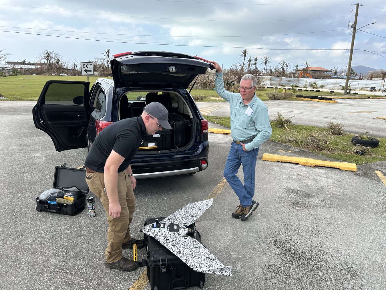
The U.S. Department of Energy (DOE) used unmanned aerial systems (UAS), Drone Unmanned Camera Kit (DUCK), to provide accurate and rapid damage assessments to aid recovery efforts after Typhoon Sinlaku.
Office of Cybersecurity, Energy Security, and Emergency Response
August 28, 2026 Estimated Read Time min
In the wake of Typhoon Sinlaku, the U.S. Department of Energy (DOE) used unmanned aerial systems (UAS) to provide accurate and rapid damage assessments to aid in recovery efforts after the storm devastated the Commonwealth of the North Mariana Islands (CNMI).
The typically lush, green, tropical islands were left brown and bare as a result of the powerful storm stripping the trees of their leaves. In response, DOE’s new tool, the Drone Unmanned Camera Kit (DUCK), and their operators were deployed to CNMI to assist with damage assessment efforts. The so-called Duck Squad supported responders, interagency partners, and electrical utilities as the island rebuilt infrastructure and restored power to residents and businesses.
During significant incidents, DOE’s Office of Cybersecurity, Energy Security, and Emergency Response (CESER) supports recovery and restoration of the energy sector as the coordinating Emergency Support Function (ESF) agency under the National Response Framework and as the Sector Risk Management Agency for the energy sector.
“When disaster strikes, getting accurate information quickly can make the difference between a prolonged outage and a faster recovery,” CESER Director Andrew McClure said. “The DUCK Squad gives responders a clearer picture of damage on the ground, helping utilities prioritize repairs, restore power faster, and get communities back on their feet.”
A team at Oak Ridge National Lab (ORNL), where the drone kits are housed, supported the DUCK Squad’s deployment capability with a suite of additional products and services, including associated image processing and analysis algorithms, the MAPSTER web portal, integration into EAGLE-I, and ongoing technical support. When disaster strikes, the DUCK Squad is able to deploy a package of drone kits, supporting communication tools, and drone operators
“ORNL’s ability to develop autonomous systems and secure, integrated data platforms is critical to national security and disaster response missions,” said Moe Khaleel, ORNL Associate Laboratory Director for National Security Sciences. “The DUCK Squad is a great example of our science-based solutions providing real-time insights to enhance decision-making in dynamic, challenging environments.”
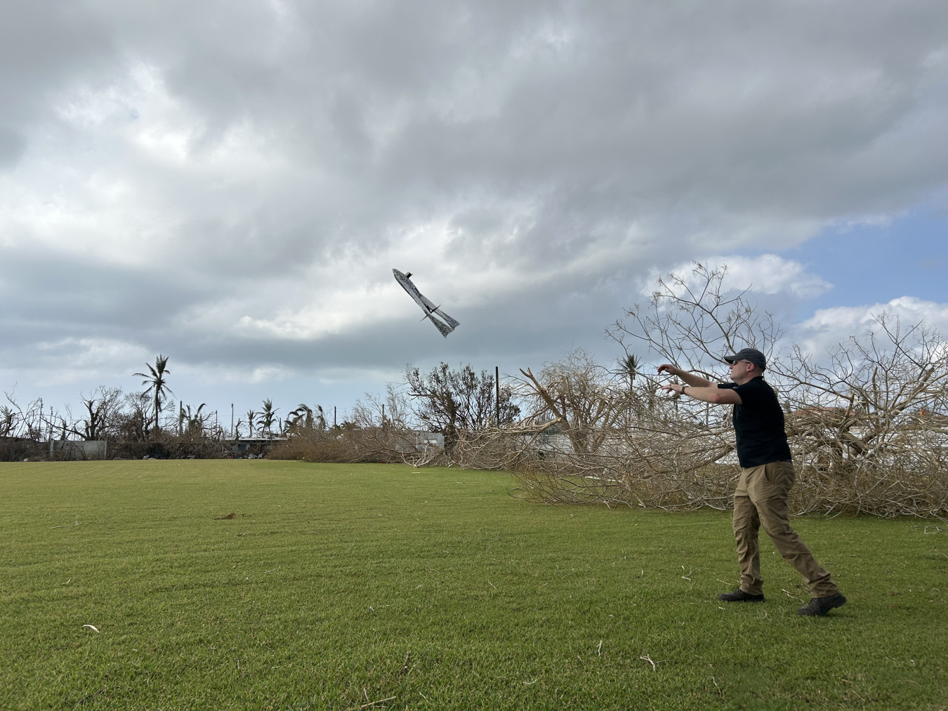
Armed with this new technology, the DUCK Squad is able to produce high quality and timely data, while operating independently in harsh environments. The Duck Squad often works in off-the-grid environments with limited resources—charging flight batteries using a vehicle power inverter and processing data mostly in the field. The data collected under these circumstances is oftentimes vital to restoration efforts after major weather events
In response to Typhoon Sinlaku, the ORNL drone team conducted 41 flights from 18 unique launch and recovery points from in Saipain in late April. During this response effort, the DUCK Squad collected approximately 38,000 images. They processed raw images into an orthomosaic map, that produces geometrically corrected aerial images. In total, they mapped 6,000 acres of Saipan using this technology, which images captured over the course of over 40 hours of flight.
Following processing, the team transmitted orthomosaics to MAPSTER, ORNL’s secure, cloud-based file sharing system, for further analysis and distribution. In addition to its file sharing capability, MAPSTER is equipped with machine learning models used to detect damaged electrical infrastructure, along with other models used to assist search and rescue missions. The DUCK Squad also uploaded maps to the Federal Emergency Management Agency’s (FEMA) ArcGIS database for review, allowing FEMA to distribute the maps through internal channels and support their own recovery efforts.
As DOE was set to demobilize from the Typhoon Sinlaku response, a second significant typhoon was headed towards CNMI. To ensure energy infrastructure restoration progress continued, FEMA extended DOE’s deployment on the islands for an additional 33 days.
The impacts of Typhoon Bavi were concentrated across the islands of Guam, Rota, Tinian and Saipan, with the most extensive damage to the energy sector on the island of Rota. The DUCK squad redeployed to CNMI to again support restoration efforts. The second deployment mission was equally instrumental to the recovery efforts of the islands’ energy systems.