
EM’s progress is transforming more than the landscape; it’s also changing an important map in Oak Ridge.
Office of Environmental Management
August 16, 2022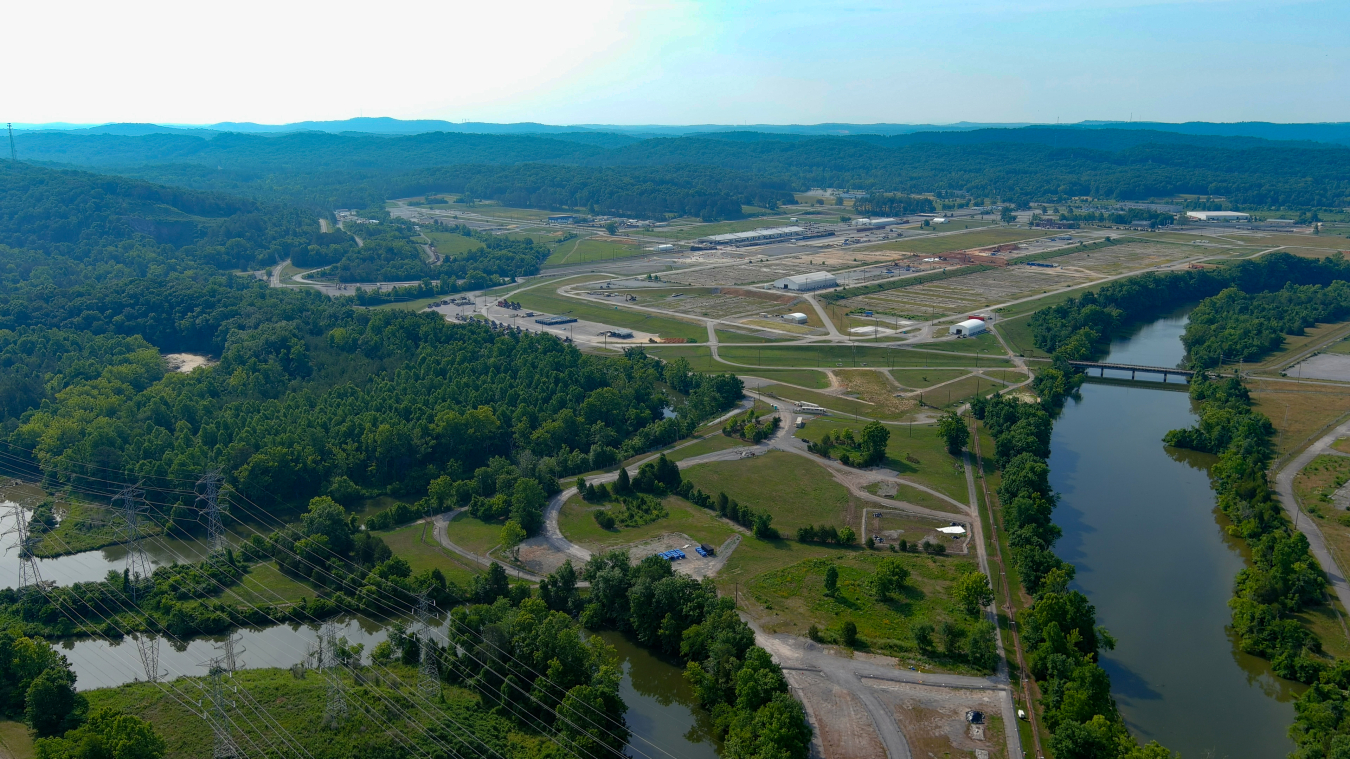
EM’s cleanup has transformed the East Tennessee Technology Park (ETTP), pictured here, from a former uranium enrichment complex into a private industrial park home to many new businesses, conservation areas and portions of the Manhattan Project National Historical Park. The ETTP cleanup has also led to a newly revised map of emergency sectors in the Oak Ridge area.
OAK RIDGE, Tenn. – EM’s progress is transforming more than the landscape; it’s also changing an important map in Oak Ridge.
DOE and the Tennessee Emergency Management Agency (TEMA) developed an emergency sector map for the Oak Ridge area designed in case a potentially dangerous event occurs at one of DOE’s three major sites within Oak Ridge — the East Tennessee Technology Park (ETTP), Oak Ridge National Laboratory (ORNL) and the Y-12 National Security Complex.
The map, which was created by establishing five-mile radiuses around each of those three sites, was recently updated since all hazards with potential offsite impacts have been eliminated from one of them — ETTP.
EM’s work at ETTP removed a former uranium enrichment complex — a world first — that had been shuttered since the 1980s. That two-decade cleanup involved crews tearing down more than 500 old, contaminated structures that together had a total footprint that spanned an area comparable to 225 football fields.
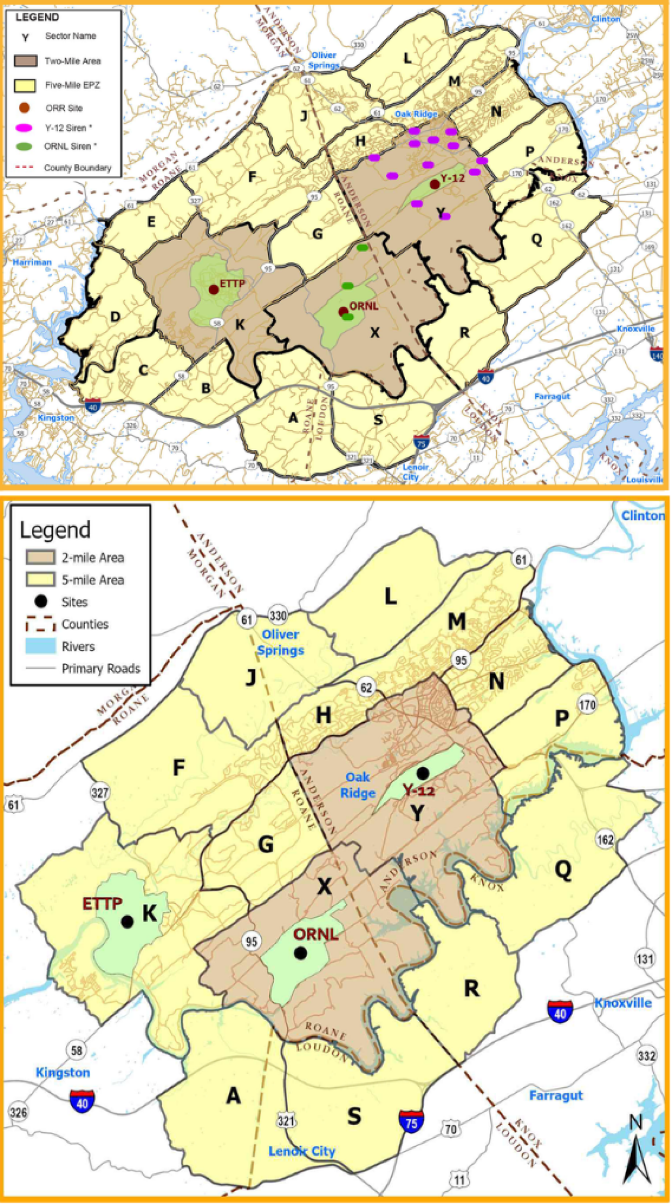
With EM’s cleanup at the East Tennessee Technology Park (ETTP) at Oak Ridge largely complete, four emergency sectors for the Oak Ridge community have been eliminated from an emergency sector map created by DOE and the Tennessee Emergency Management Agency. The previous map, at top, compares with the updated map, immediately above, which shows the removal of sectors B, C, D and E around ETTP.
Removal of the risks at ETTP led to the elimination of four emergency planning zones for the Oak Ridge community. That means homes, businesses and schools on the city’s west side near ETTP are no longer included in the emergency sectors.
"To reduce the footprint and to make it more efficient, we've eliminated four of the sectors,” said Roger Thompson, a program manager with TEMA. “That way we can concentrate more of our resources to areas that are outside the five-mile area of ORNL and Y-12, which still have hazards that can get offsite."
The removal of all potential offsite risks from ETTP and the elimination of four emergency planning sectors is a tangible measure of EM’s impact.
With major cleanup complete at ETTP, cleanup crews are busy addressing hazards and risks at the other two DOE sites in Oak Ridge — Y-12 and ORNL.
The ongoing work to address and remove hundreds of old, contaminated buildings at those sites will continue enhancing safety for the region.
In addition to updating the emergency sector map, DOE and TEMA have released an updated booklet informing the community how to remain safe and prepared in the event of an emergency. That booklet is available on the Y-12 and TEMA websites.
To receive the latest news and updates about the Office of Environmental Management, submit your e-mail address.