
EERE and USGS are improving energy integration and affordability and providing Americans with reliable energy and mineral resources.
Geothermal Technologies Office
September 16, 2020In our respective roles we are bringing together some of the best minds in the country to coordinate research and development (R&D) on energy and minerals. Together, the Department of Energy’s Office of Energy Efficiency and Renewable Energy (EERE) and the Department of the Interior’s U.S. Geological Survey (USGS) are improving energy integration, affordability, and diversity, and providing Americans with secure and reliable energy and mineral resources.
Energy is at the heart of American life, and the need for affordable domestic energy has never been greater. As indicated by DOE’s 2019 report, GeoVision: Harnessing the Heat Beneath Our Feet, one key opportunity to support this need is through the use of geothermal energy. USGS’s own national-scale geothermal assessment estimates that more than 30 GWe of undiscovered conventional geothermal resources exist in the United States – enough to power more than 20 million households. First, we need to locate and harness these renewable sources of energy.
Likewise, minerals are fundamental for sustaining our advanced economy. Our country faces an important challenge in finding ways to improve domestic availability of critical minerals such as lithium. In 2018, DOI issued a list of 35 mineral commodities that are essential to our nation’s economy and security, and in 2019, the Administration published A Federal Strategy to Ensure Secure and Reliable Supplies of Critical Minerals. This strategy directed DOE, DOI, and other agencies to identify new sources of mineral resources, explore innovative methods of producing and recycling them, and partner with state, academic, and industry experts to support the economic security and national defense of the United States.
DOE and DOI have partnered before on these important topics. DOE’s Play Fairway Analysis (PFA) used USGS data to help reduce exploration risk by locating and qualifying such resources. Leveraged from the oil and gas industry, PFA has proved successful at targeting undiscovered geothermal resources in several geologically favorable regions across the western United States. Now, we plan on bringing our joint expertise to bear in the Silver State.
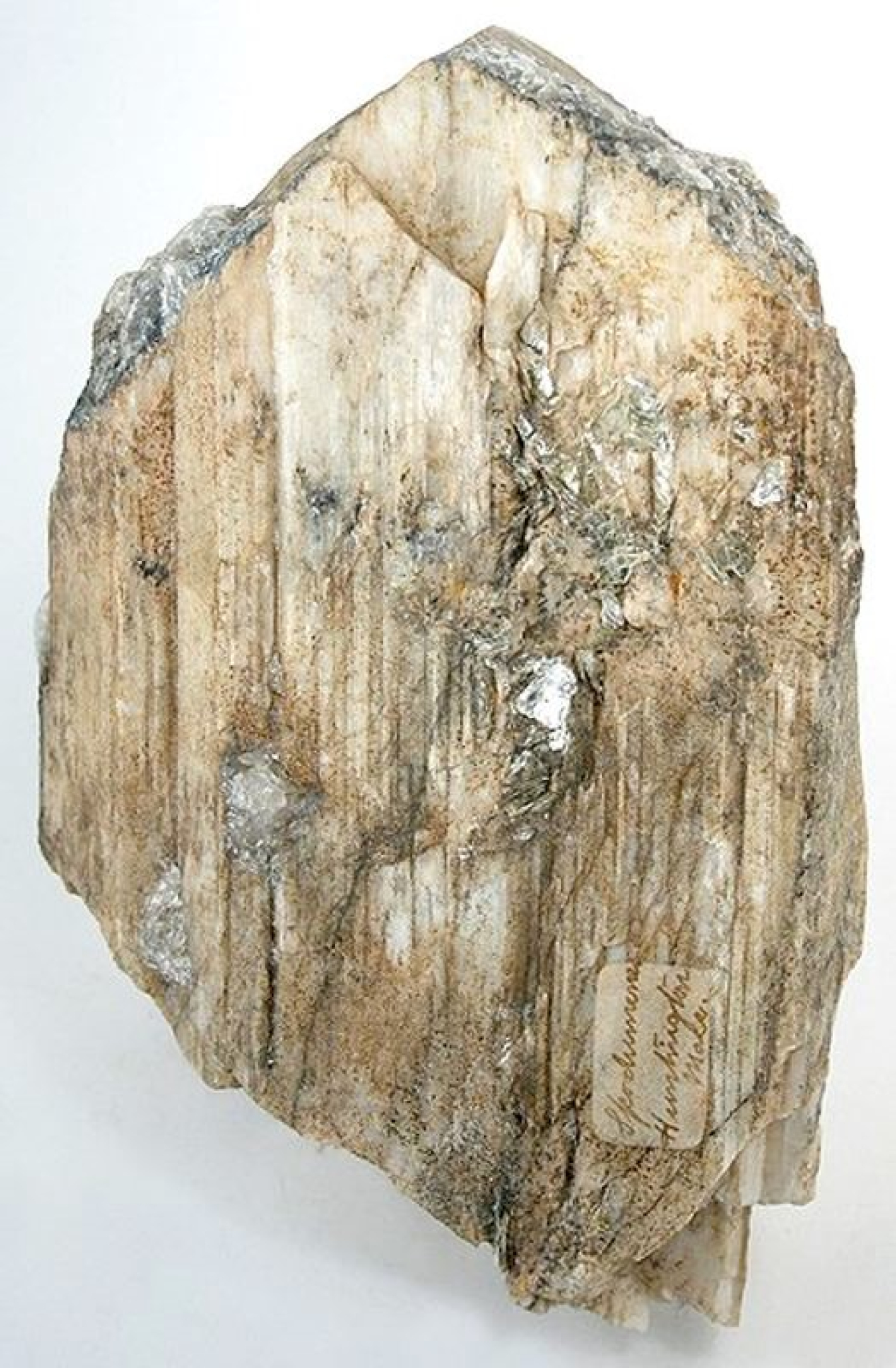
Minerals like spodumene (as shown) are important sources of lithium. The GeoDAWN initiative will collect data across broad areas in Western Nevada, such as the Clayton Valley. Image courtesy of irocks.com.
The Partnership – Leveraging Data for Combined Benefits
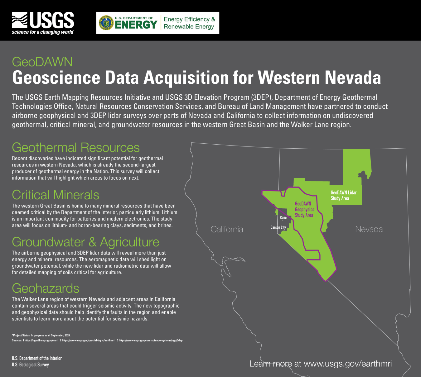
A recent interagency agreement—Geoscience Data Acquisition for Western Nevada (GeoDAWN)—unites EERE’s Geothermal Technologies Office (GTO) with the USGS Earth Mapping Resource Initiative (Earth MRI) and 3D Elevation Program (3DEP) to help provide solutions to meet U.S. needs for both energy and critical minerals. Under the GeoDAWN collaboration, researchers will gather new subsurface data specifically in the Walker Lane geologic zone in western Nevada.
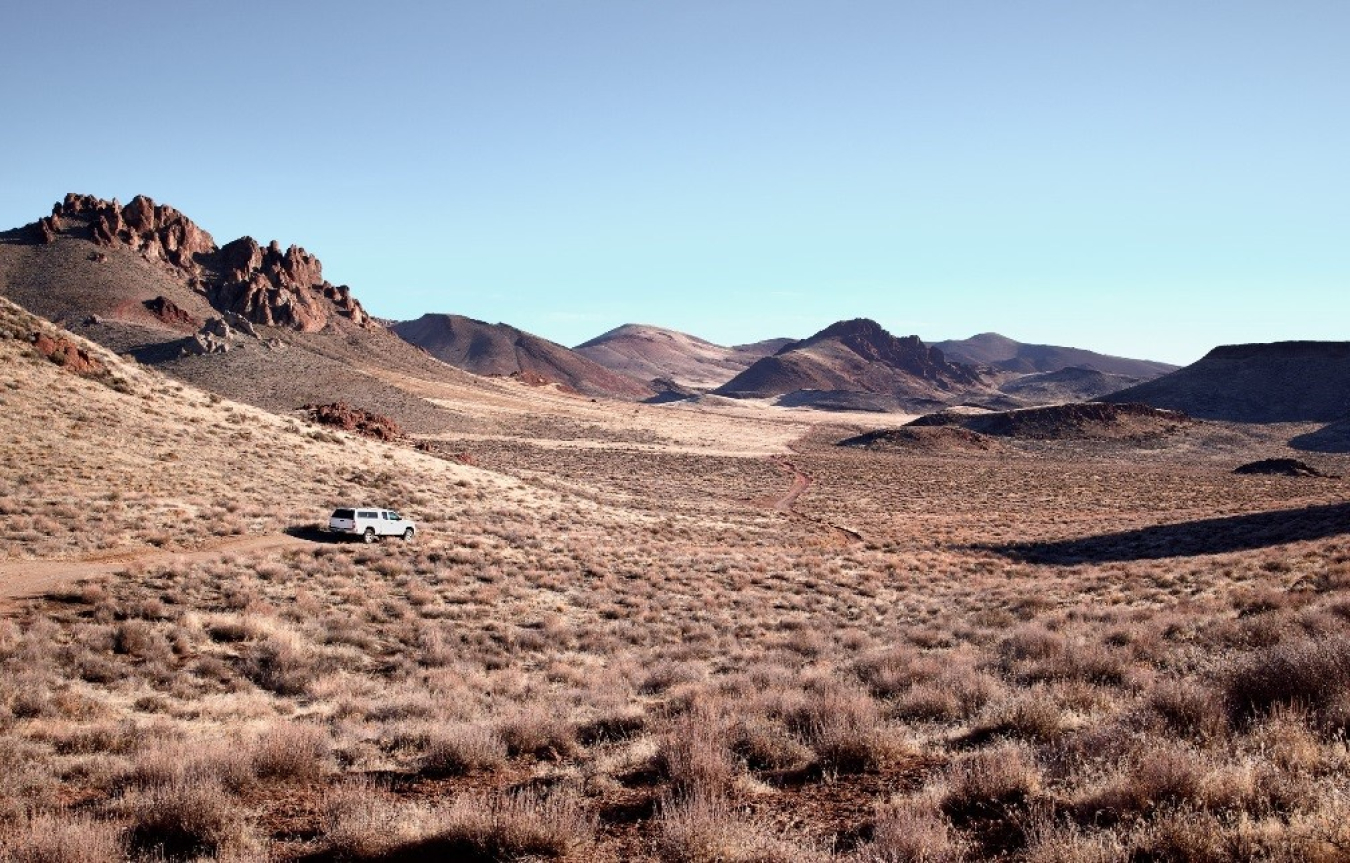
Nevada sits at the heart of the Basin and Range, an area marked by striking geologic features including an array of narrow, high-capped ridges and plateaus interspersed among dozens of dry sloping valleys. The area of focus is highly prospective for geothermal resources—Nevada is second only to California in geothermal energy production and capacity—and offers a legacy of producing mined and refined ores. At or near the surface, where Earth MRI research is conducted, sediments and clays can contain significant quantities of critical materials.
GeoDAWN researchers will leverage machine learning applied to data collection from this area that is rich in both geothermal and mineral resources to develop deeper understanding of the geologic conditions and stress regime that gives rise to these resources. These geophysical data will thus be utilized for dual objectives—locating undiscovered geothermal resources while also identifying critical mineral deposits that can be mined for domestic use.
Innovative Research and Added Benefits
The datasets acquired under the GeoDAWN collaboration will form the basis for innovative machine learning that can enhance the ability to remotely characterize the subsurface. The massive scale of the study area and the large datasets that will be captured will enable the application of a variety of advanced machine learning techniques to the problem of locating subsurface resources. This will include a high-resolution aeromagnetic survey, where low-flying aircraft equipped with magnetometers detect and measure anomalies in the Earth’s magnetic field that correspond with regional subsurface structures; and lidar collection, wherein a detailed 3D model of the Earth’s topography is formed by scanning the surface from an aircraft with a pulsating laser and analyzing the return signal. These techniques allow researchers to see and analyze faults where they intersect the surface and to detect patterns in subsurface electromagnetic properties that may indicate conditions that are favorable for geothermal and/or mineral resources.
This data collection will further strengthen the Earth MRI initiative, a partnership that includes state geological surveys and industry to generate state-of-the-art geologic mapping, geophysical surveys, and lidar data to improve knowledge of the geologic framework underlying the United States. The lidar data, in particular, will contribute to the 3DEP goal to complete acquisition of nationwide lidar by 2023. This will provide the first ever national baseline of consistent high-resolution elevation data—both bare earth and 3D point clouds—in a timeframe of less than a decade.
This collaborative work furthermore aligns with GTO’s mission to reduce the risks and costs associated with geothermal exploration and production, as well as with DOE’s broader strategic commitment to provide complementary assessments of critical and strategic minerals. The data could also benefit other U.S. industries—especially mining, agriculture, and oil and gas—and can provide deeper understanding of the origin and evolution of mineral, energy, and water resources across a sizable portion of the western United States.
As GeoDAWN gathers momentum, we look forward to new discoveries and opportunities. We plan to provide periodic updates to interested stakeholders as we work together to strengthen American energy and critical mineral independence. We are actively expanding partnerships across other federal agencies with a connection or interest in subsurface resources. This agreement and alignment of our federal departments and agencies enhances our understanding of geologic conditions and data, expanding our opportunities to bolster America’s economy, workforce, and resource independence.
Daniel R Simmons, Assistant Secretary for the Office of Energy Efficiency and Renewable Energy, U.S. Department of Energy
Dr. Timothy R. Petty, Assistant Secretary for Water and Science, U.S. Department of Interior
More by this author
-
Former Assistant Secretary for the Office of Energy Efficiency and Renewable Energy