Small unmanned aircraft systems perform topographic mapping at LM sites.
April 6, 2021The U.S. Department of Energy (DOE) Office of Legacy Management (LM) established its Aviation Program in 2020 to accommodate the growing use of small unmanned aircraft systems for performing long-term surveillance and maintenance at LM sites.
By providing accurate, high-resolution data on site conditions while minimizing risk to field staff, the program supports LM’s greater mission of protecting human health and the environment.
“Our site stewardship mission in LM will continue for generations to come,” said Deb Steckley, LM Aviation Program manager. “I expect the Aviation Program to prove itself an invaluable tool for providing us with accurate data on site conditions and reducing risk of employee injury, especially in hard-to-access areas and uneven terrain.”
The Aviation Program builds on a baseline aerial survey project that LM initiated in 2018, using small unmanned aircraft systems to perform topographic mapping at a handful of Uranium Mill Tailings Radiation Control Act (UMTRCA) disposal sites. The goal of the project is to establish detailed baseline conditions of the sites, including topography, vegetation, and surface water characteristics. The high-resolution, three-dimensional imagery that resulted is already helping LM enhance long-term surveillance and maintenance activities and remedy potential site issues before they become costly and result in noncompliance.
At LM’s Mexican Hat, Utah, Disposal Site, the baseline aerial survey helped LM investigate subtle depressions, first identified in 2016, on the northeast side slope of the cell. And at the L-Bar, New Mexico, Disposal Site, where erosion surrounding the cell has progressively worsened over time, the survey has helped LM develop a three-dimensional model of site conditions and topography to assess the problem. The model was used to brief U.S. Army Corps of Engineers partners on the extent of the issue for an upcoming project to repair the erosion and construct additional control structures at L-Bar.
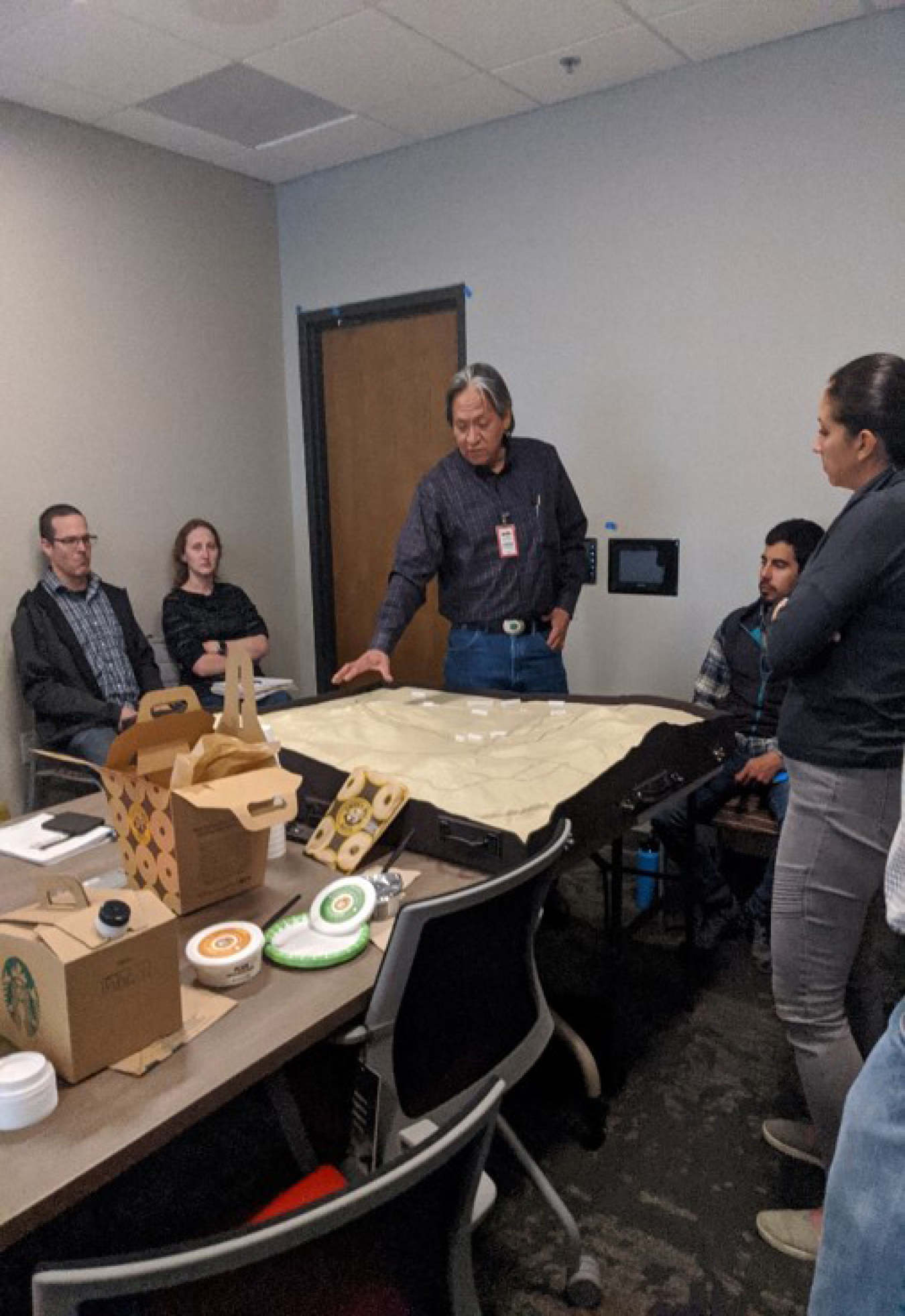
The L-Bar survey also resulted in the development of innovative stakeholder outreach materials, including a physical, three-dimensional site model and a fly-through video. LM has used the model during science, technology, engineering, and mathematics (STEM) events for high school students to demonstrate concepts in environmental science, hydraulics and hydrology, and long-term surveillance and maintenance.
The next steps for LM’s Aviation Program are to continue supporting the baseline aerial survey project and collaborate across LM with site managers, GIS specialists, and other technical staff to effectively enhance long-term surveillance and maintenance for generations to come.
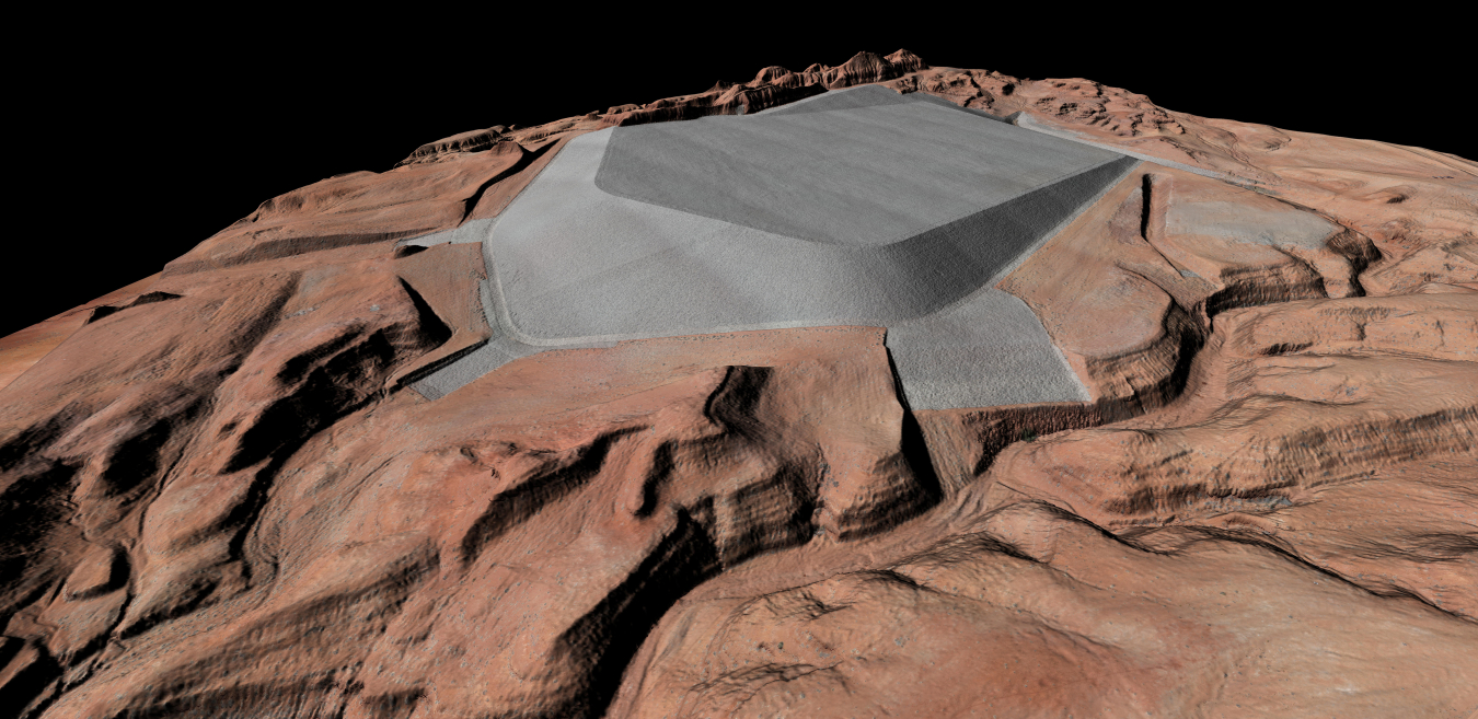
Mexican Hat, Utah, Disposal Site model
A digital surface model of LM’s Mexican Hat, Utah, Disposal Site combines lidar (laser-based radar) and aerial imagery to generate a three-dimensional surface.
Bill Frazier with site model
Bill Frazier, site manager for LM’s L-Bar, New Mexico, Disposal Site, uses a three-dimensional model of site conditions and topography during a briefing with the U.S. Army Corps of Engineers.