Portsmouth Annual Site Environmental Reports

The Portsmouth Site environmental monitoring program samples for radiological and chemical contaminants in air, water, soil, sediment and biota (animals, vegetation, crops) on and near the plant site. Each year, more than 5,000 environmental monitoring data samples are collected. These samples provide over 100,000 environmental sampling results that are assessed to see if site activities have impacted the public or the environment. The results of these monitoring efforts are reported in the Annual Site Environmental Report (ASER). The ASER is prepared each year for the public. Copies of the ASER are available here.
Air-Monitoring
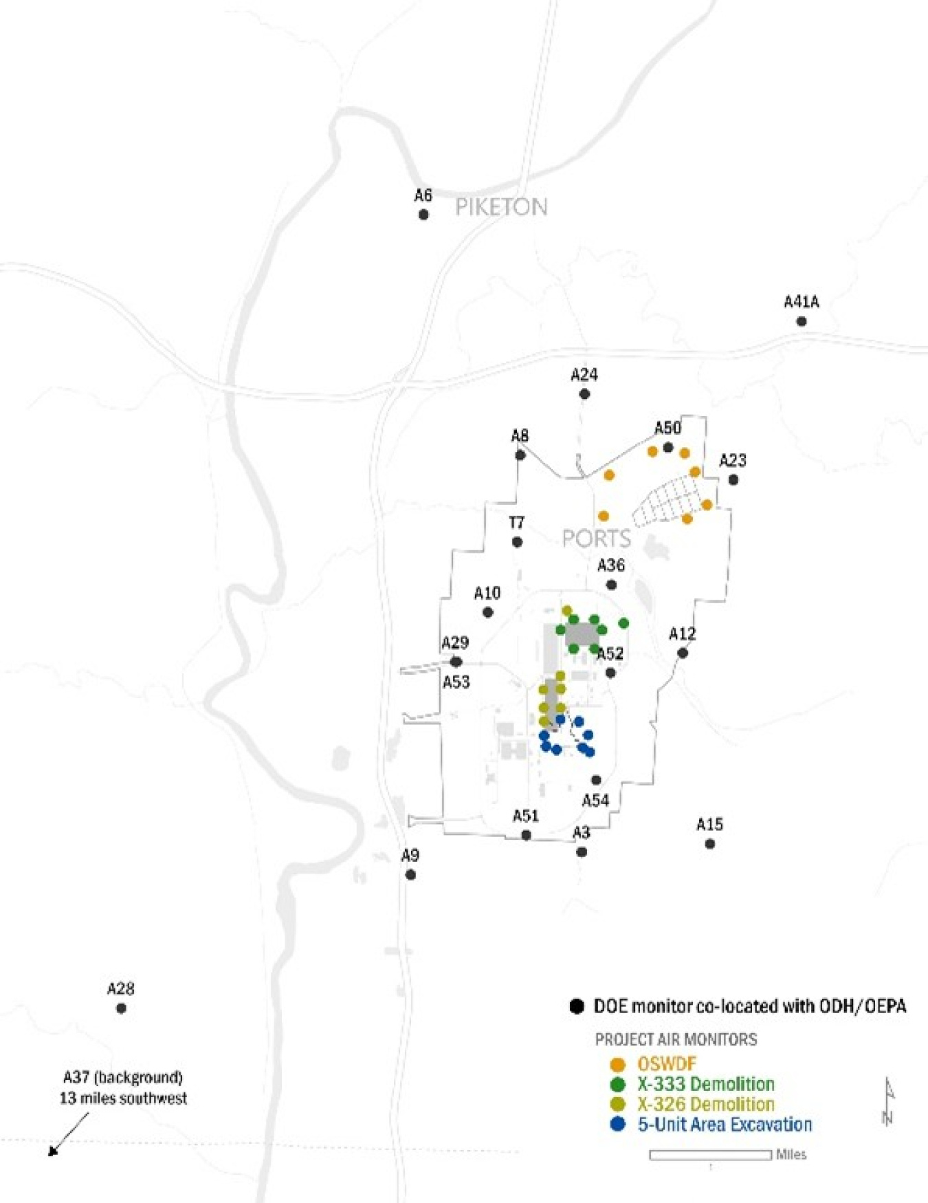
The Portsmouth Site air-monitoring network provides a layering of air monitoring equipment from the project boundary to off-site locations. Using input from the community, DOE lessons learned, industry best practices and meteorological data, DOE worked with Ohio Environmental Protection Agency (EPA) and Ohio Department of Health (ODH) to co-locate 23 air monitoring stations. Co-located means that both DOE and Ohio EPA or ODH take samples at the same location and analyze and report the data independently. Environmental data is reported on the PPPO Environmental Geographical Analytical Spatial Information System (PEGASIS) website.
Demolition Project Air-Monitoring
As DOE prepared for demolition of the site’s process buildings, DOE worked with health and safety experts, the ODH and the Ohio EPA to develop additional environmental monitoring layers to focus on demolition activities.
During demolition activities, airborne contamination is controlled and monitored for effectiveness. Fixatives are applied to the exterior of facilities with potential loose contamination to prevent contamination from being released during demolition. It is also applied to the piles of demolition debris on the ground. In addition, water misters suppress dust during demolition to act as further dust suppression.
Project monitors are located around current demolition areas to ensure that dust suppression measures are sufficient. DOE monitors in real-time for particulate matter, or PM and Alpha/Beta Radiation. PM is small dust or droplets. Alpha/Beta is an airborne alpha and beta radioactivity on dust particles.
The real-time monitors are an early warning system for any possible releases. Project personnel receive the data to make any necessary adjustments to the demolition process. During the X-326 Process Building demolition, there were no exceedances of regulatory standards in the air monitoring results from the project or site air monitors.
DOE is committed to safely completing demolition of the Portsmouth Gaseous Diffusion Plant process buildings, delivering on our mission to fully clean up the Portsmouth Site. We will maintain trust with our community partners through timely, transparent release of monitoring data and other project information continuing an open dialogue throughout the project.
Current Status:

Real-time project monitoring data is gathered for PM and Alpha/Beta radiation. The real-time monitors are an early warning system for any possible releases and allow the project personnel to make any necessary adjustments to the demolition process promptly. Raw real-time data is reported weekly.
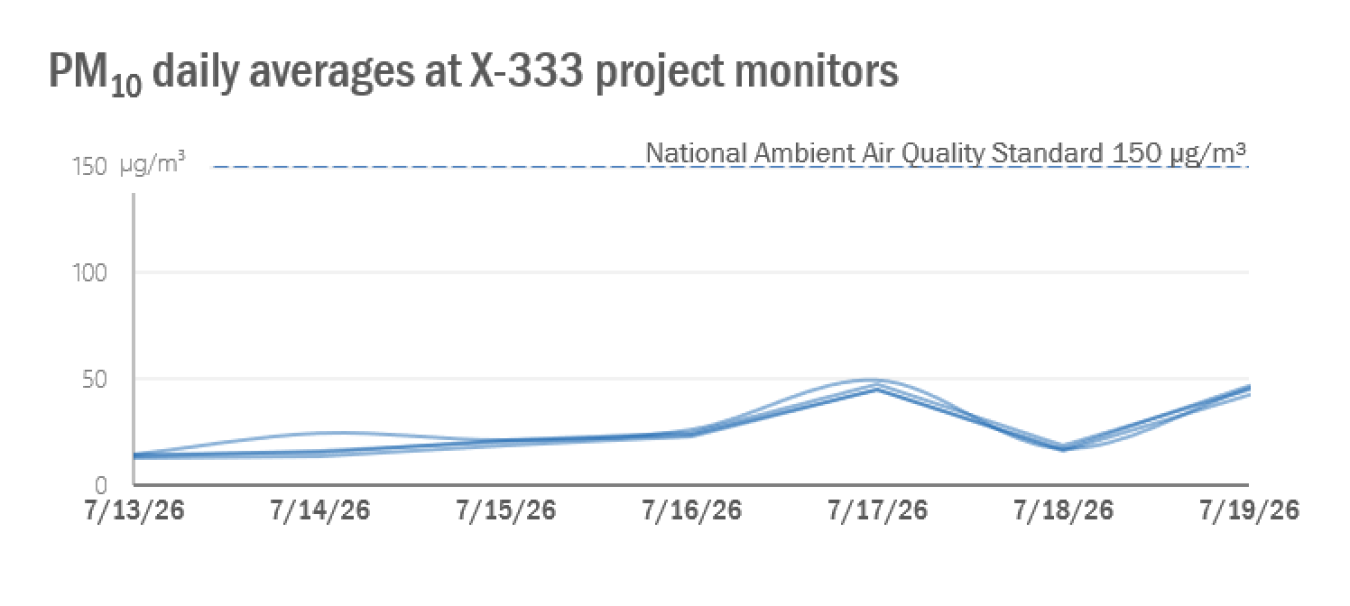
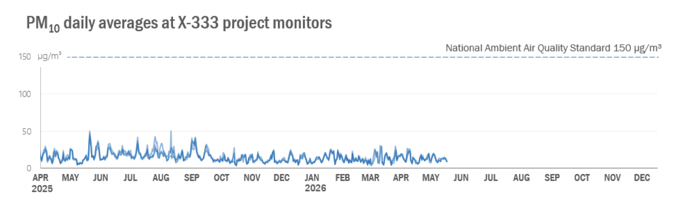
PM10 Monitoring
PM10 is small dust or droplets, also called particulate matter, that are ten microns or less.
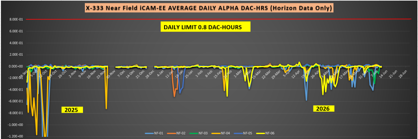
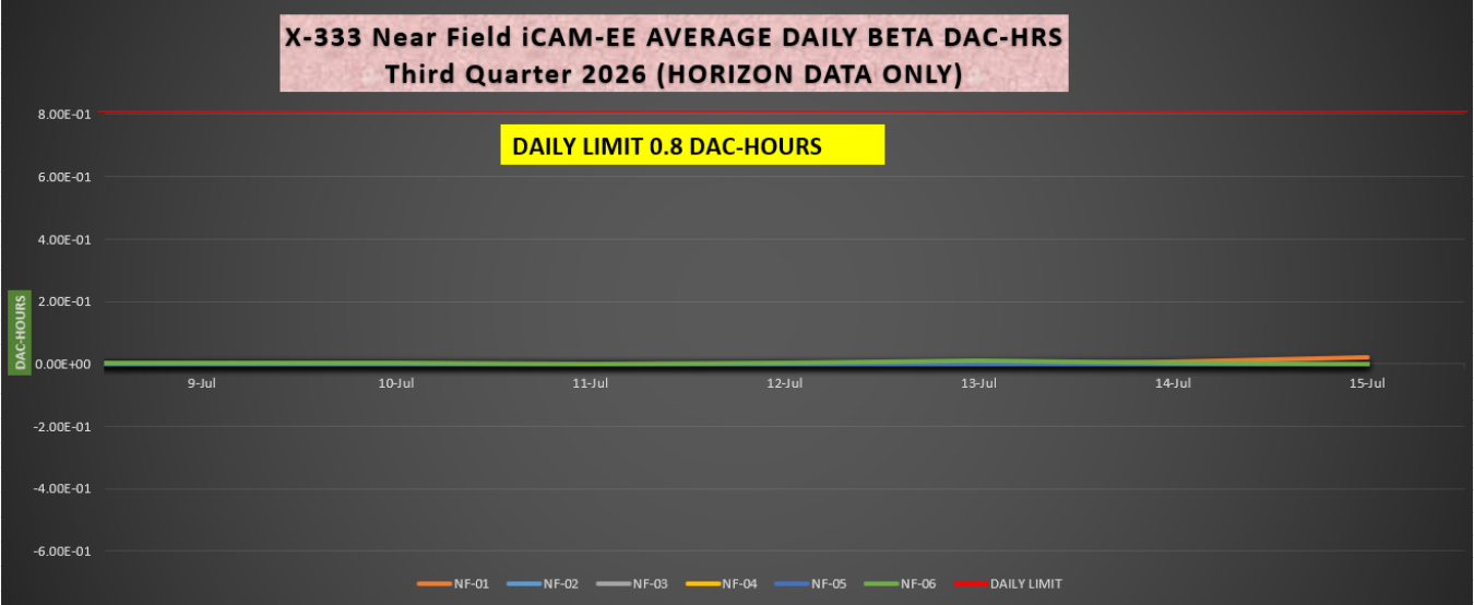
Alpha/Beta Monitoring
Alpha/Beta is an airborne alpha and beta radioactivity on dust particles.
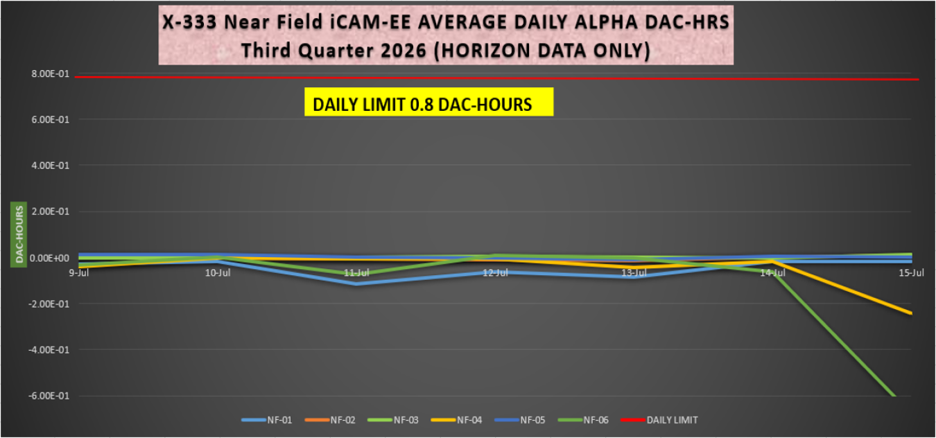
Monthly project air monitoring data includes the real-time data that has been validated. Data validation is a systematic process of evaluating data to ensure it is accurate, consistent and reliable. The validation process identifies any data that fails to meet pre-established quality control criteria, which helps maintain data integrity and excludes incorrect, incomplete or irrelevant information and supports accurate decision-making. For example, raw data may include instrument testing, which artificially elevates a particulate to check the instrument’s response to field conditions. Those results are not included in the final validated data set.
PM10 Monitoring
PM10 is small dust or droplets, also called particulate matter, that are ten microns or less.
Alpha/Beta Monitoring
Alpha/Beta is an airborne alpha and beta radioactivity on dust particles.