
$1.3-million upgrade extends lidar reach and data recovery rate; provides more accessible information.
Integrated Energy Systems Office
June 1, 2020$1.3-million upgrade extends lidar reach and data recovery rate; provides more accessible information
This article is part of the
Harnessing the power of the wind blowing along the nation’s coasts could potentially provide more than 2,000 gigawatts of generating capacity.
But the wind industry faces obstacles in developing offshore wind technology, including the ability to obtain wind measurements at turbine-blade height.
Over the past few years, WETO has commissioned PNNL to deploy buoys equipped with advanced scientific instrumentation off the coasts of the United States and analyze the data. The goal is to obtain meteorological and oceanographic measurements that provide the wind industry with the data needed to develop robust offshore wind plant technology while advancing the scientific understanding of offshore winds.
However, analysis of data obtained from two research buoys in 2016 and 2017 deployed off the coasts of New Jersey and Virginia found that the lidar signal was too weak to obtain satisfactory wind measurements at heights near the top of a wind turbine rotor. Without special data processing, the rate of change of the wind with height was also incorrect.
This finding spurred the wind industry to suggest instrument upgrades and best-practice validation that meets the recommended industry practices of a third-party organization. WETO, which funds much of the buoy research, listened, and a team of PNNL wind researchers led the $1.3-million upgrade.
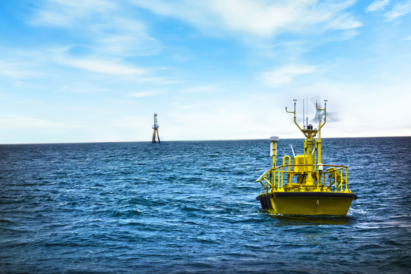
Buoys stationed off U.S. coasts collect meteorological and oceanographic data that can help the wind industry make informed decisions for offshore wind power plants. Image: Ocean Tech Services, LLC, and PNNL
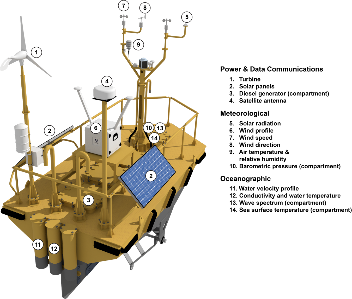
The buoys are equipped with power and data communications, meteorological, and oceanographic capabilities for assessing offshore wind. Wind profile, which is #6 in the graphic, represents the lidar unit. Illustration: Mike Perkins, PNNL
“The upgrades included more powerful lidar that reaches a height of 200 m and provides a high data recovery rate,” said PNNL’s Alicia Gorton, who led the effort. “Previous lidar capability reached about 90 m, which is now somewhat inefficient because offshore turbines are built much taller than those constructed and deployed 5 years ago.”
Additionally, the team is moving the buoys’ data management systems to an open-source environment for easier access and download of data by the wind community.
After the upgrades, the buoys were put back in the water to actively collect data as part of the validation stage. Validation involved comparing the data acquired on the buoys with data collected by a sanctioned reference lidar on the Woods Hole Oceanographic Institution Air-Sea Interaction Tower off the coast of Martha’s Vineyard. The buoys, with their new lidar systems, have now been certified as compliant with published recommended practices for data recovery and accuracy.
The buoys are being transported to the coast of California where they will collect data for one year in support of the Bureau of Ocean Energy Management.
Spring 2020 R&D Newsletter
Explore previous editions of the Wind R&D Newsletter or browse articles by topic: