
As the contribution of wind energy to U.S. electricity generation grows, so does the importance of accurate forecasts for wind power production.
Integrated Energy Systems Office
May 8, 2018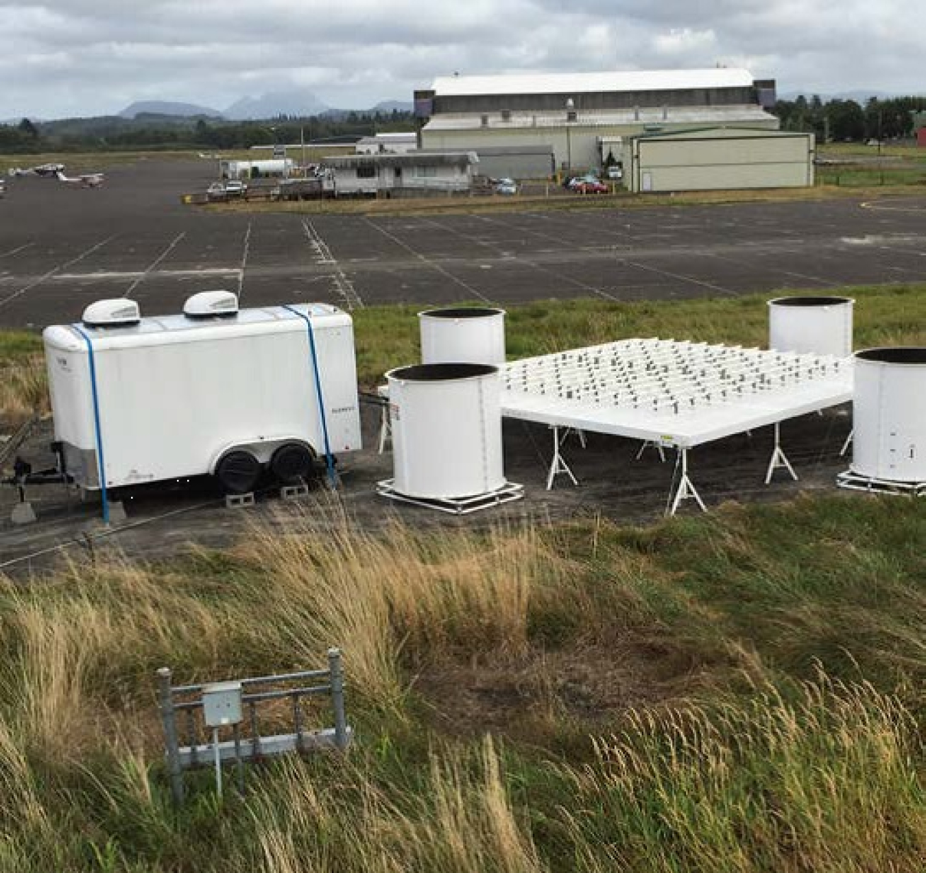
On this wind profiler, an array of 26 antennae on the platform operate in series to measure wind speed and direction up to 8 kilometers high. Photo courtesy of Clark King, National Oceanic and Atmospheric Administration Earth System Research Laboratory
As the contribution of wind energy to overall U.S. electricity generation grows, so does the importance of accurate forecasts for wind power production. These forecasts help maintain stability in the electrical grid and keep power costs low.
Through a collaboration between the U.S. Department of Energy (DOE) and the National Oceanic and Atmospheric Administration (NOAA), three new wind measurement systems on the Pacific Coast are helping improve wind forecast accuracy. Following 2 years of successful operations, the systems officially transferred to NOAA in November 2017.
Deployed by researchers from the Pacific Northwest National Laboratory and NOAA, each system consists of several components. A wind profiler—a type of radar—obtains measurements of wind speed and direction up to 5 miles into the atmosphere. The profiler is surrounded by a radio-acoustic sounding system that adds temperature measurements up to 1.8 miles. An adjacent meteorological station collects standard weather data, such as surface wind speed and wind direction, pressure, and humidity. Together, the equipment provides a "vertical profile" of weather conditions in the area.
A previous DOE study conducted in the Midwest established that additional wind data to initialize the forecast models greatly improved their accuracy. Because weather systems generally move from west to east, the new systems were sited on the coast in Forks, Washington, and Astoria and North Bend, Oregon.
Data are compiled hourly and made available on NOAA's Meteorological Assimilation Data Ingest System. Anyone can access the data, but it's especially useful for NOAA's National Weather Service, which relies on data from across the country to feed its regional forecast models.
Spaced about 155 miles apart, the new systems complement an existing network of coastal profiling radars in California.
This "picket fence" closes a gap in model boundary conditions along the West Coast.
The new systems also contributed to another recently completed DOE field study in the Columbia River Gorge region of Oregon and Washington. That effort focused on collecting wind data to improve the underlying physics algorithms in forecast models.
Fed into forecast models, the wind profiler data can help energy planners determine whether they should buy more wind or use other energy sources. The publicly available data can also be used for research that will eventually benefit the wind industry. Visit the DOE Coastal Wind Profiler project for additional information.