
Hawaii’s Renewable EnerGIS mapping tool provide renewable energy resource and site information for specific Hawaii locations.
June 5, 2018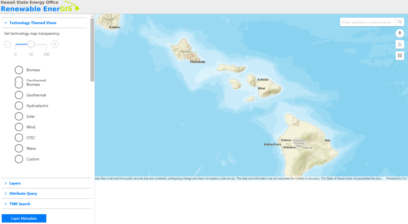
Hawaii’s Renewable EnerGIS Mapping Tool
Hawaii’s Renewable EnerGIS mapping tool was developed in 2012 to provide renewable energy resource and site information for specific Hawaii locations to help landowners, developers, policy makers, and other stakeholders understand the renewable energy potential of different sites statewide. While it was an important first step towards identifying Hawaii’s renewable resource potential, the original EnerGIS platform lacked the sophistication necessary for users to quickly assess a site’s technology and development potential and also lacked robust data points specific to geothermal possibilities. Although Hawaii has significant potential for geothermal generation, oftentimes complicated siting and permitting processes have hindered private sector investment in geothermal infrastructure development. Recognizing these missed opportunities, the Hawaii State Energy Office (HSEO) invested $50,000 of its SEP formula award in 2017 to upgrade EnerGIS by increasing functionality, usability, and incorporate more data points specific to geothermal siting and permitting. Specifically, the enhanced EnerGIS tool includes:
- The ability for users to search for sites with certain attributes that may or may not be desired for development such as island, acreage, solar radiation, land use district, potential warm groundwater, soil type, and/or the presence of critical habitats.
- The ability for users to search by parcel identifier (tax map key number), street address, and place name.
- The addition of “Technology Themed Views” with pre-selected data layers associated with a given renewable energy technology. For example, the ‘Geothermal’ theme contains data layers showing:
- Thermal Springs/Potential
- Geothermal Wells
- Geothermal Boundaries
- Potential Warm Ground Water
- High Temperature Resource Areas
“Thanks to support from the U.S. Department of Energy, the Hawaii State Energy Office (HSEO) has been able to implement projects, such as Renewable EnerGIS, that are helping Hawaii pursue its goal of 100% renewable energy in the electricity sector,” said Luis P. Salaveria, Director of the State Department of Business, Economic Development, and Tourism. “The upgraded Renewable EnerGIS platform is an important tool in this effort because it will allow for better use of Hawaii’s indigenous renewable resources, including solar, wind and geothermal.”
The new Renewable EnerGIS tool may be found at: http://geodata.hawaii.gov/energis