
The U.S. Department of Energy (DOE) Office of Legacy Management (LM) manages nearly 40 years of legacy site environmental records, generated since the days of the Cold War. These key LM assets must be managed and maintained efficiently and effectively, so the applications, respective systems, and processes currently being used are undergoing significant Next Generation (NextGen) upgrades to improve future operations.
LM uses a custom, web-based Geospatial Environmental Mapping System (GEMS) application to gather validated information for 58 sites that have been transferred into our long-term surveillance and maintenance (LTS&M) program. Nearly 4.7 million analytical results and 232,000 water-level measurements are captured and stored in the database, including:
- Historical environmental information
- Analytical chemistry data
- Groundwater depths and elevations
- Well logs and well construction data
- Geo-referenced boundaries
- Site physical features
- Sampling locations
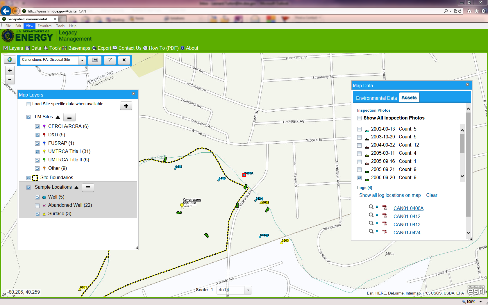
Image
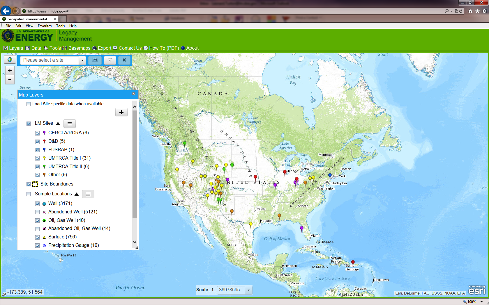
|
| GEMS—Main Screen. |
Image
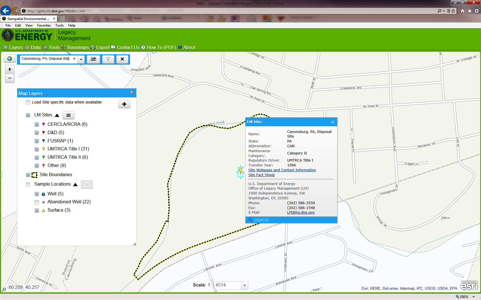
|
| GEMS—Site-Specific Pop-Up Data. |
Image
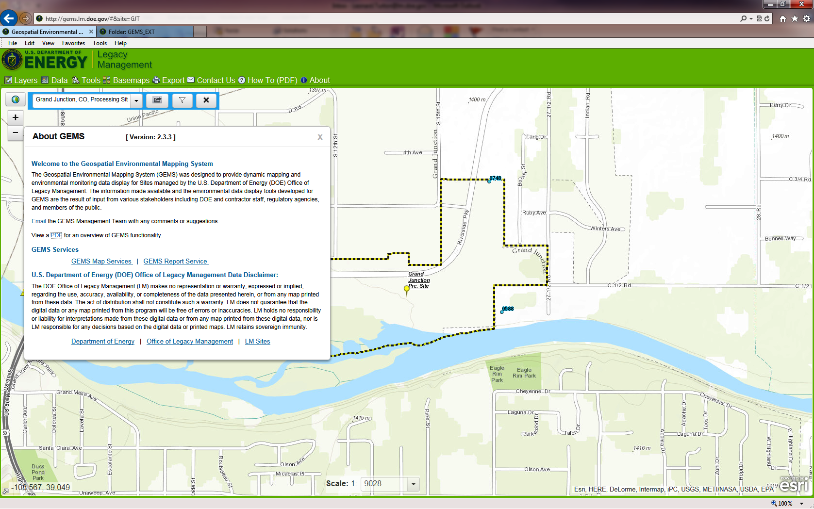
|
| GEMS—Help Screen and Links to Mapping and Reporting Services. |
Stakeholders, regulators, and project personnel can use GEMS to design interactive tabular reports, graphs, and geospatial displays. Data can also be labeled or highlighted in map views.
LM relies on comments from GEMS users, including site stakeholders, to improve mapping functionality and layering capabilities, and also for making adjustments that make the application easier to use. User input has also benefitted creation of a common platform for cross-agency map sharing, new functionality, and collaboration.
Image
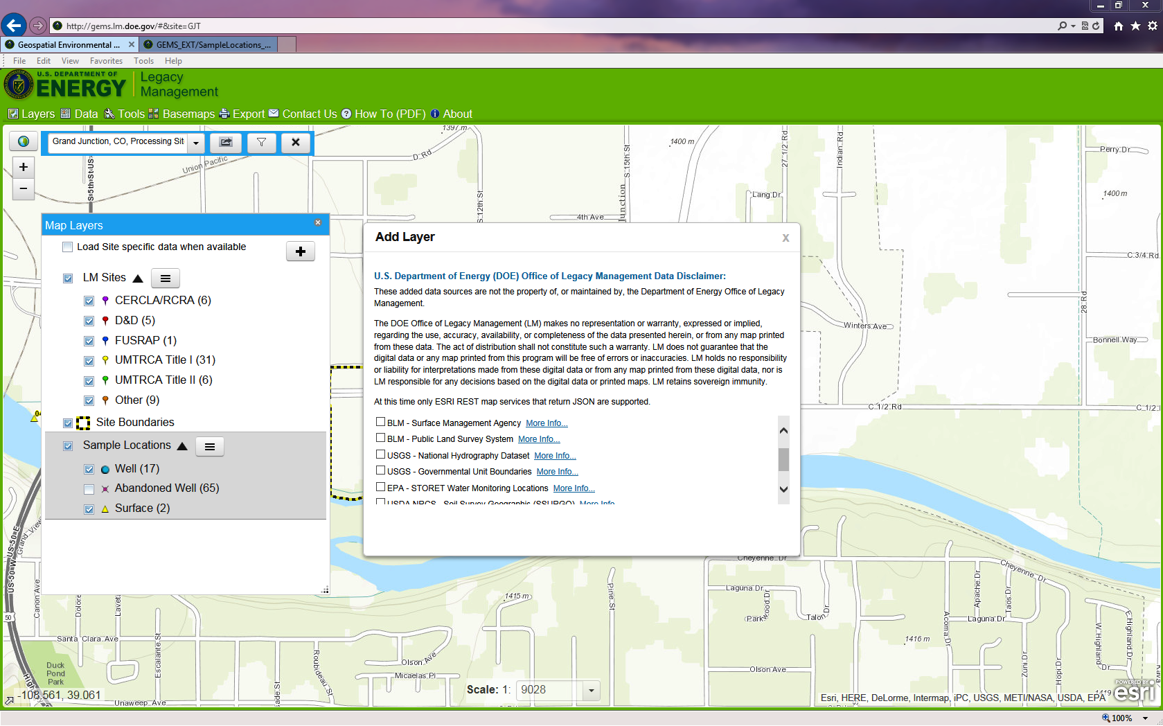
|
| GEMS—Adding External Mapping Services to Map. |
Image
|
| GEMS—Find/Access Site Photos and Logs. |
NextGen and its associated processes help ensure LM environmental data is properly preserved and protected while still allowing us to operate openly with state and federal regulators; local, regional, and national stakeholders; and the general public. LM engages stakeholders by showing the capabilities and new functionality of GEMS via video and live-feed demonstrations.
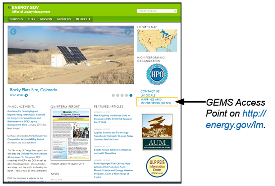
GEMS can be accessed through the LM website (http://energy.gov/lm) by selecting Mapping and Monitoring (GEMS) on the right hand side of the screen, or by inserting http://gems.lm.doe.gov directly into a web browser. Comments and suggestions can be submitted through the GEMS Contact Us or About menus.
Image
|
NextGen GEMS is more user friendly and designed for positive display on smaller laptop screens and tablets. The application is more versatile for analyzing environmental data, including saving to CSV—or plain-text format—files (Microsoft Excel compatible) for self-analysis. It provides easy access to site logs and inspection photos, and has the ability to overlay external mapping features onto LM-focused site maps.
LM is focused on releasing GEMS 2.4 in late May 2015. This version will have improved access to LM site-specific aerial imagery through a slider bar, updated reports, and many other visual enhancements. Future versions of the system will integrate land use (e.g., parcel ownership, mineral rights, covenants), institutional controls (e.g., land restrictions and access agreements), and also include real and personal property layers.
Along with improving the visual aspects of GEMS, LM continues to improve access to the mapping and reporting services. This concept allows stakeholders easy access to data for reports, and the capability to load map format services into their own geographic information system (GIS) using GEMS web application Esri Representational State Transfer services. Application users can also rely on GEMS for outside mapping services through the U.S. Bureau of Land Management Public Land Survey System and U.S. Geological Survey Data National Hydrography Dataset, to incorporate data onto the GEMS map. We will continue to collaborate with other agencies such as GEMS Mapping and Specific Information the U.S Environmental Protection Agency, National Oceanic and Atmospheric Administration, and U.S. Geological Survey to promote GIS technology, reduce redundant systems, and transfer knowledge for potential LM sites.
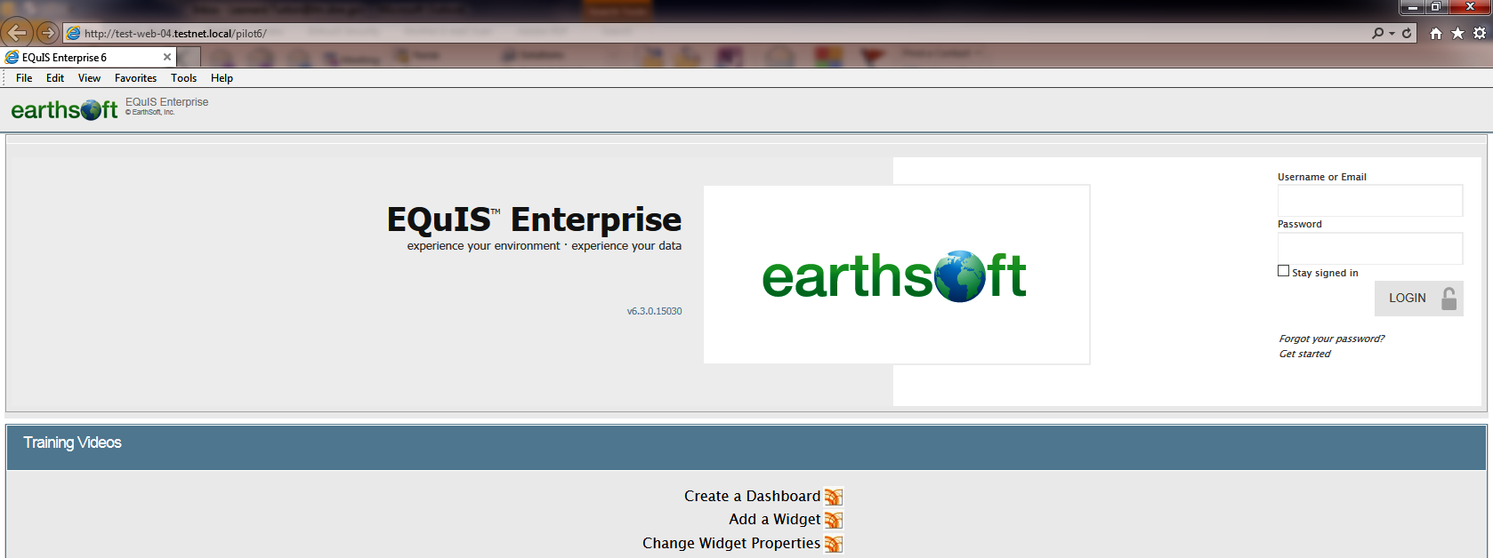
NextGen GEMS is currently being integrated with a new environmental database commercial off-the-shelf (commonly known as COTS) product named EQuIS. We are working with our EarthSoft, LLC partner to implement the cradle-to-grave environmental management system. Tentative plans have been made for the first set of legacy sites is to go live this September 2015. The target for completing final data migration is March 2016.
The EQuIS system will provide more efficient and effective support of our LTS&M mission when the all new integrated process and toolset replaces the 16 existing individual systems and manual processes used in the LM environment today.
Image
|
| EQuIS—Sample Main Login Screen. |
Image
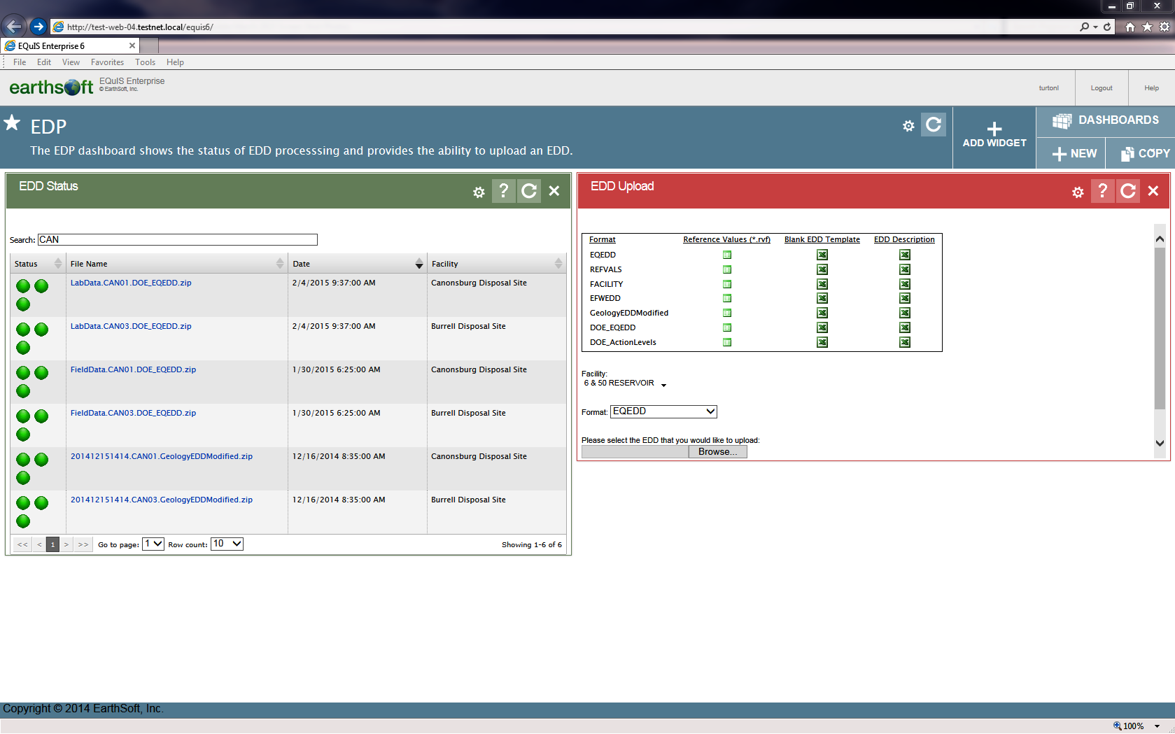
|
| EQuIS—Sample EDD Status Dashboard. |