
Aviation Program technology plays an integral part in LM's work in monitoring disposal cells.
November 22, 2021From hundreds of feet in the desert air, the birds’-eye view of a drone can read the letters on a technician’s T-shirt – and after receiving the drone’s survey data, so can the scientists who sit hundreds of miles away at the Department of Energy (DOE) Legacy Management Office’s (LM) office in Grand Junction, Colorado.
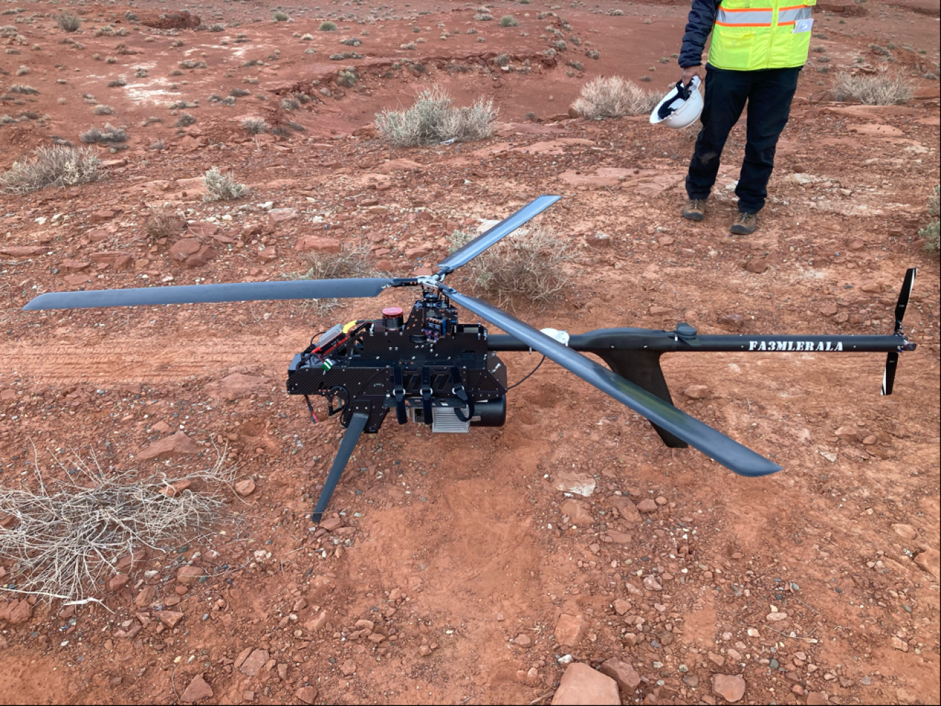
A drone is prepared to conduct an aerial survey of the Mexican Hat, Utah, Disposal Site in October.
It’s part of LM’s Aviation Program, through which evolving aerial capabilities are helping monitor sites nationwide. The program relies upon lidar, a remote sensing method that uses pulsed lasers to measure ranges and distances as well as the capturing of photogrammetric -- or three-dimensional, electromagnetic-sensitive -- images. Just south of the San Juan River at Mexican Hat, Utah, Disposal Site, drones conduct photogrammetry and lidar surveys to inspect an engineered structure called a disposal cell that contains and stabilizes residual radioactive materials, which remain from Cold War-era nuclear testing. Commercial aviation services direct the drone as it circles the cell, snapping images from every angle. The unmanned aircraft captures the site’s topography, vegetation, and surface water characteristics.
"Using photogrammetry and lidar to measure even the slightest change at a site is a gamechanger,” said Deborah Steckley, Aviation Program Manager at LM. “This high level of 3D precision shapes the approach we take to stewarding our sites, in both the short and long term. The information we gather incrementally can help us make predictions for the care of the cell for centuries to come.”
Steckley joined the DOE in 2011 as a physical scientist at the Grand Junction, Colorado office.
“Today, the Aviation Program technology plays an integral part in LM's detail-oriented work and upholds best-in-class safety practices that inform every step we take in monitoring our sites and stewarding local communities,” Steckley says.
LM’s Aviation Program supported the baseline aerial survey project at Mexican Hat by collaborating across LM and the Legacy Management Support contractor with aviation safety experts, site managers and leads, and technical staff to effectively enhance long-term surveillance. Aviation safety plans were developed specifically for each drone deployment.
Over the past three years data gathering has established baseline conditions at Mexican Hat. Now, scientists can use the high-resolution photography and 3-D models, to inform decisions to send staff into the field for further monitoring. The team identified subtle levels of erosion and determined exactly where and to what extent the damage had occurred, saving time when it came to deploying personnel to the site to address it. Since these initial findings, LM’s aerial capabilities have continued to improve, alongside the safety measures and public outreach surrounding these endeavors.
Mexican Hat, Utah is located on the Navajo Reservation. Site manager, Angelita Denny and her site support worked with the Aviation Program, local leaders and stakeholders to ensure all nearby communities were aware of drone usage and its applications. From hosting information sessions to distributing pamphlets door-to-door, LM personnel went the extra mile in furthering education and awareness around the technology.
“From the very beginning of this program, site personnel and public affairs have engaged with the Navajo Nation and surrounding public to answer questions and shed light on our aerial capabilities and applications,” Steckley says. “It’s imperative that we continue to respect and build trust with these communities – that relationship is what sustains our work for generations.”
Built on a foundation of top safety standards and trust, LM’s Aviation Program is redefining effective and efficient long-term surveillance and maintenance.