
The National Energy Technology Laboratory (NETL) has sponsored a project being conducted by Fugro and Areté Associates to develop a new technology called the Remote Ocean Current Imaging System (ROCIS). ROCIS is the first commercially available system...
Hydrocarbons and Geothermal Energy Office
October 26, 2016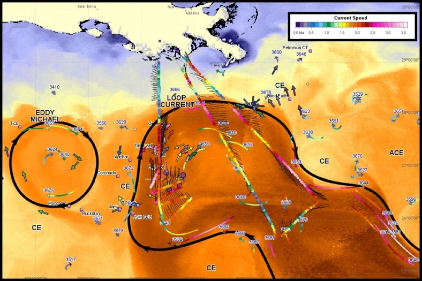
For as long as humans have been taking to the sea—from Viking longships to modern day yachts—determining the whims of the water has been vital. While today’s ships are better equipped to navigate stormy weather and adverse currents, real-time data on offshore current conditions has the potential to provide critical information in emergency situations, as well as offering oceanographic scientists an important asset to their research.
The National Energy Technology Laboratory (NETL) has sponsored a project being conducted by Fugro and Areté Associates to develop a new technology called the Remote Ocean Current Imaging System (ROCIS). ROCIS is the first commercially available system that can monitor offshore current velocities—from the air. By equipping aircraft with digital cameras, positioning systems, and highly advanced image processing algorithms, ROCIS can survey between 500–680 miles of ocean currents in just four hours.
While in the air, the data collected by the ROCIS system is analyzed and within an hour of landing, researchers and emergency personnel can access a “quick-look” map of ocean conditions. Never before have such accurate, timely assessments of ocean conditions been available.
The system has already been deployed in a research setting—collecting data about offshore currents in the U.S. Gulf of Mexico during a period of intense activity. The project lasted five months, and ROCIS was used to capture data on more than 78,000 miles, a distance roughly equivalent to three trips around the world! NETL is excited to have sponsored such a cutting-edge technology that is already commercially available, filling a unique niche and offering, not just critical research information, but potentially life-saving assistance to emergency response operations.