EERE Success Story—Remote Data Collected by High-Tech Research Buoy Now Available to Offshore Wind Industry
Office of Critical Minerals and Energy Innovation
July 18, 2016
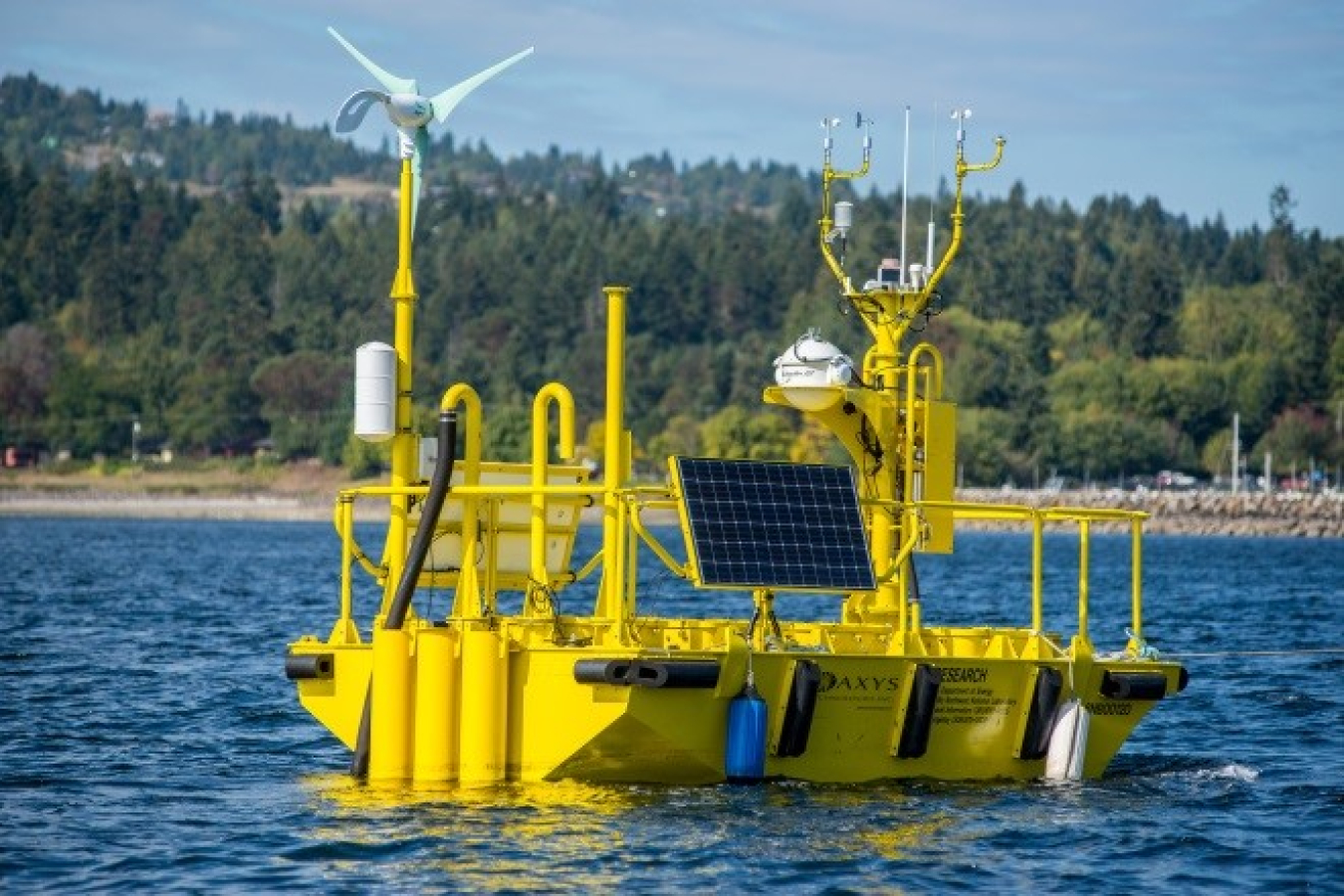
An Energy Department buoy that recently ended a 19-month deployment off Virginia Beach, Virginia, collected a wealth of data that is now available to help offshore wind industry partners optimize offshore wind farm development and design. Photo courtesy of Pacific Northwest National Laboratory.

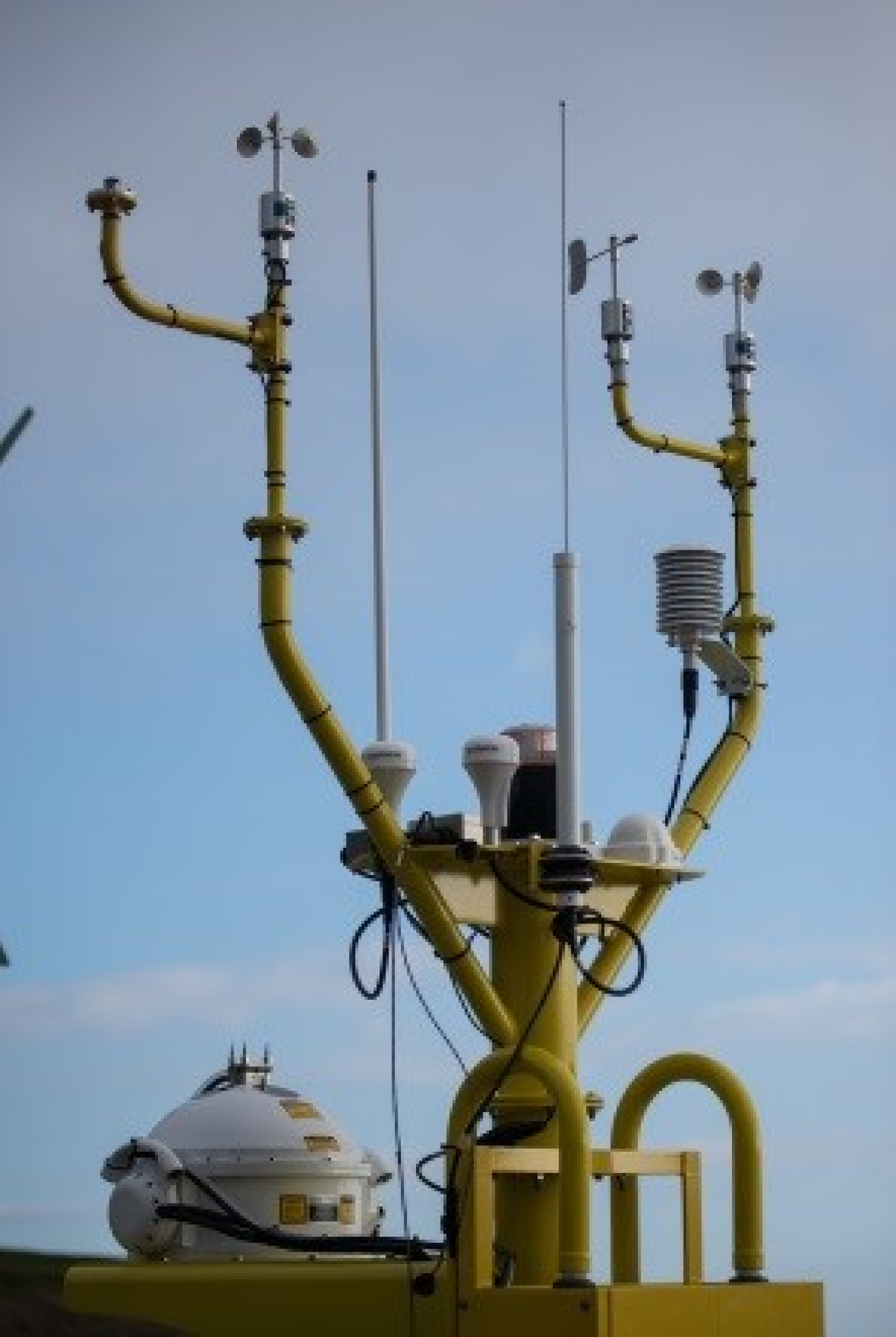
Meteorological instruments aboard the Energy Department’s offshore wind power research buoys include anemometers (small white spinning cups on towers) and LiDAR (large white ball at bottom), among many others. These instruments provide data that will help improve offshore turbine performance and reduce barriers to investment in large-scale offshore wind energy development. Photo courtesy of Pacific Northwest National Laboratory.
Energy Department Buoy Holds Record for Longest Single Deployment After Collecting 19 Months of Data Off Virginia Coast
One of two research buoys commissioned by the Energy Department's Pacific Northwest National Laboratory has ended a 19-month deployment off Virginia Beach, Virginia. During this time, the heavily instrumented buoy collected a wealth of information, which forms the first publicly accessible database to help improve offshore turbine development and reduce barriers to private investment in the offshore wind industry.
According to AXYS, the buoy’s manufacturer, this was the longest deployment of any of its WindSentinel buoys. While achieving this record-setting deployment, the buoy recorded data through a full cycle of seasons—including two winters and two springs—providing long-term offshore wind profile data that will help researchers, turbine manufacturers, financial institutions, and others in the industry understand the different conditions under which offshore wind farms operate.
This buoy, along with a second Energy Department research buoy currently deployed off the coast of Atlantic City, New Jersey, recorded offshore wind data between 150 feet and 500 feet above the sea surface, where offshore wind turbines operate. This data will help designers understand turbine loads, developers understand power production, and financiers understand their investment risks by having greater certainty about how much energy a wind site project can produce, sell, and supply to the grid.
The research buoys provide data that reveal a clearer picture of air-sea interactions and their site-specific impact on offshore wind turbine power production. A light detection and ranging (LiDAR) device shoots a series of lasers more than 500 feet into the sky and measures their reflection to characterize wind speeds at various altitudes. Additional meteorological and oceanographic instruments record air and sea surface temperature, barometric pressure, relative humidity, wave height and period, and water salinity. Acoustic Doppler sensors measure subsurface ocean currents. All of this information helps characterize the specific site conditions under which offshore wind turbines and foundations will be subject.
Although the field campaign in Virginia is over, the work of this research buoy is not. The Energy Department is exploring potential partnerships that will make it possible for the buoy to continue collecting critical data that will improve U.S. offshore wind development cost and efficiency in the future.
The data collected by the Energy Department buoys is accessible to the public. To learn more about the Energy Department’s offshore wind energy research efforts, visit Offshore Wind Advanced Technology Demonstration Projects.

