
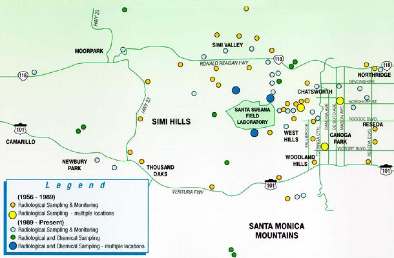
During the more than 70-year history of nuclear research and later environmental restoration at the Santa Susana Field Laboratory (SSFL), onsite and offsite environmental monitoring and sampling has been extensive, as shown in the sampling map.
The Department of Energy (DOE) is one of three responsible parties, along with The Boeing Company and NASA, charged with cleaning up SSFL. While DOE does not own any land, the department is responsible for remediating Area IV and the Northern Buffer Zone.
More information about the history of SSFL can be found on the About Us page, on Boeing’s website or on NASA’s website.
Learn about the studies conducted in the areas surrounding SSFL and view reports on air monitoring, noise and traffic, offsite data evaluation, annual site environmental monitoring, and national emission standards for hazardous air pollutants.
During the 1990s, extensive sampling programs were conducted on the northern neighbors, including the Brandeis-Bardin Institute and the Santa Monica Mountains Conservancy, the neighbors to the south, the Boeing Recreation Center in West Hills, various private homes in the Chatsworth and West Hills areas, and as far as Wildwood Park and Tapia Park.
Detailed information about the studies conducted in the surrounding areas is provided below.
Read Ongoing Environmental Sampling for information about the environmental sampling for radiation and radioactivity surrounding SSFL.
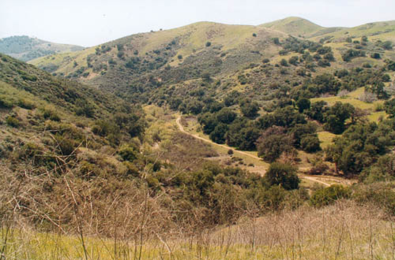
Ahmanson Ranch
Ahmanson Ranch was a proposed housing development to the west of SSFL, but it has not been developed and is now designated as parkland. The Ahmanson Land Company sampled the proposed development area for the presence of contaminants and results indicated no radiological contamination is present.
Read the section of the Report of Environmental Sampling, Ahmanson Ranch, Ventura County, CA prepared for the Ahmanson Ranch Land Company focusing on the radiological results below.
Note: There is a typographic error on page 24. Table 16 of the report contains the correct information.
In June 2003, the California Department of Health Services (DHS) sampled the water from seven wells at the proposed Ahmanson Ranch and failed to find any contamination. Read the DHS Ahmanson Groundwater Sampling report.
Bell Canyon
Sampling in the nearby Bell Canyon community was conducted in June 1998 to evaluate whether chemical or radiological contaminants had migrated from SSFL.
Located to the south of SSFL, Bell Canyon residents are the closest residential neighbors to SSFL. is located to the south of SSFL. The residents of Bell Canyon are the nearest residential neighbors. Stormwater runoff from a large portion of Area IV flows through the Bell Canyon area and concerns were raised about the possibility of contaminants moving offsite into the neighborhood.
The sampling was performed by Boeing contractors and observed by three regulatory agencies: the California Department of Toxic Substances Control (DTSC); the Department of Health Services Radiologic Health Branch; and the U.S. Environmental Protection Agency (EPA). An environmental scientist from California State University, Northridge (CSUN) also observed the sampling.
In October 1998, the results of the sampling project were presented to Bell Canyon residents in the Bell Canyon Presentation.
The Bell Canyon residence sampling program work plan was developed to support the sampling and the Bell Canyon residence sampling program work plan attachments incorporate an EPA fact sheet about regulatory oversight of SSFL, the Health and Safety Plan, and the Quality Assurance Plan.
The EPA reviewed the work plan, provided oversight of the field work, took split samples and analyzed the samples for radiological constituents. The following are the EPA results which confirm the Bell Canyon sampling report results. Several agency letters providing their results (and in some cases interpretations) of the Bell Canyon samples are also available.
- U.S. EPA National Air and Radiation Environmental Laboratory gamma analysis results
- U.S. EPA National Air and Radiation Environmental Laboratory gross beta and alpha analysis results
- U.S. EPA split sampling results from Bell Canyon sampling
The Department of Toxic Substances Control (DTSC) took split samples for chemical analysis and concluded that the dioxin levels observed at Bell Canyon were safe. Read the DTSC letter about their role in the Bell Canyon sampling and the DTSC letter about their evaluation of the Bell Canyon sampling results.
Brandeis-Bardin and Santa Monica Mountains Conservancy
A study was conducted to determine whether radiological and chemical contaminants are present on the properties north of SSFL. Phase I field work was conducted in 1992 and documented in 1993. Phase II field work was conducted in 1994 and documented by the U.S. Environmental Protection Agency (EPA) in the EPA Update, July 1995.
Following completion of the sampling, the EPA determined that radionuclides on the Brandeis-Bardin property do not pose a threat to human health and the environment.
The following reports provide more detail about the sampling effort:
- Phase I Reports (1992)
- Phase II Reports (1994)
Periodically, questions are raised related to trace levels of plutonium-238 (Pu-238) measured on Brandeis during the 1992 sampling. The presence of Pu-238 was not confirmed by more extensive sampling at the same location during 1994. That portion of Brandeis-Bardin was purchased by Rockwell International in 1995 and more information is available in the report titled Plutonium-238 at Brandeis-Bardin.
Chatsworth Reservoir
The Chatsworth Reservoir is a dry reservoir located two miles east of SSFL.
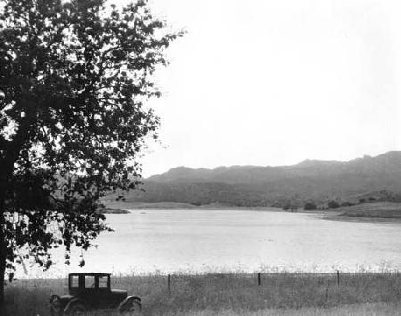
Atomics International sampled soil and water from the reservoir in the 1950s and 1960s and results were reported in the Annual Site Environmental Reports (ASERs) from that time. No contamination was observed from this sampling.
In 2004, Essentia Management Services conducted a Soil Suitability Evaluation for the Los Angeles Department of Water and Power (LADWP) in the Chatsworth Reservoir that analyzed samples for chemical and radiological constituents.
The report concluded that "the unsaturated soil and groundwater underlying the reservoir bottom do not appear to contain constituents that would pose a health risk if the soil were used as a borrow material for earthworks construction for future industrial LADWP projects."
Read the Chatsworth Reservoir Sampling and Testing Report for more information.
Dayton Canyon
Dayton Canyon is the site of a proposed Centex Homes housing development called Sterling Properties. It is located west of the intersection of Roscoe Boulevard and Valley Circle Boulevard in West Hills, less than a mile from the eastern property boundary of SSFL.
Dayton Canyon was extensively sampled in October 2005 for Cesium-137 (Cs-137) and gross alpha and gross beta radionuclides. The site was extensively sampled again in January 2006 for Strontium-90 (Sr-90), Plutonium-238 (Pu-238) and Plutonium-239 (Pu-239). The results were reported by Allwest Remediation and reviewed by Cabrera Services. Read the Radiological Investigation Report - Dayton Canyon Site, West Hills, California, and the Technical Memorandum - Review and Evaluation of Radiological Survey and Laboratory Results for more information.
The Department of Health Services was asked to review the 2005/2006 soil radionuclide data. In their report they concluded, “These concentrations and risks are below those that would pose an undue health and safety concern for residential land usage.” View the Letter from Gary Butner (DHS) to Sayareh Amir (DTSC) released at the time.
Nevertheless, the California Department of Toxic Substances Control (DTSC) recommended further sampling, and Allwest Remediation prepared the Supplemental Radiological Investigation Sampling and Analysis Plan in September 2006. Allwest Remediation then published the results of the new round of sampling in the Supplemental Radiological Investigation Sampling and Analysis Results in June 2007.
Auxier & Associates were then commissioned to interpret the radiological data and calculate a risk assessment. They issued their report, titled Radiological Characterization of Dayton Canyon, West Hills, California, in February 2008.
Auxier concluded that, "Using the available information presented in this report, no areas of radiological concern were identified in the canyon. Visual examination of concentration data plotted on aerial photos of the site indicates that the higher results are scattered across the site and not clustered together. A statistical comparison of surface and subsurface concentrations failed to prove that they were different populations. These two observations indicate soil concentrations of the radionuclides investigated are relatively uniform across the entire study area. The soil concentration data was used to calculate the exposure potential to a hypothetical receptor living on the property. Risks to this postulated receptor from Cs-137, Pu-238, Pu-239/240, and Sr-90 are relatively small, with the calculated upper-bound risk above background about 4 x 10⁻⁷. Risks of this magnitude are less than the 10-6 to 10-4 risk range generally considered by EPA to be acceptable at Superfund sites."
Rocketdyne Recreational Center
The Rocketdyne Recreational Center is located to the north of Roscoe Boulevard on Farralone Avenue in West Hills, approximately two to three miles from the SSFL.
In 1997, personnel from the Lawrence Livermore National Laboratory (LLNL) conducted soil sampling at the Rocketdyne Recreation Center and analyzed the soil for Cesium-137 (Cs-137).
LLNL's Investigation on Cs-137 Content of Soil Collected from the Boeing North American Inc. concluded that "sampling and analysis did not reveal any evidence that cesium-137 present in these soils could have been derived from local contamination. Furthermore, the levels and cesium-137 soil inventories over the study site can be adequately explained by direct deposition of global fallout through the period 1945-1997. This suggests that the data is derived from "background" concentrations."
Runkle Canyon
Runkle Ranch is the site of a proposed housing development to the west of SSFL. As part of the environmental impact studies for this project, various soil sampling programs have been implemented at Runkle Ranch. Read the reports listed chronologically below:
- Results of Preliminary Soil Sampling at Runkle Ranch
- Final Report - Runkle Ranch Site Investigation
- Site Investigation Report of the Western 350 Acre Parcel
- Site Investigation Report of the 550 Acre Parcel
- Site Investigation Report of the 715 Acre Parcel
In April 2005, Dade Moeller and Associates prepared a report for the Runkle Ranch developer evaluating the radiological health risk to people that may live on the property in future residential developments. Titled Radiological Health Risk of Strontium-90 in Runkle Canyon Development, the report concluded that health risk to future residents is less than one in a million.
In 2005, the California Department of Health Services (DHS) performed soil sampling at the Runkle Canyon locations that had shown the highest levels of Strontium-90. The DHS 2005 Soil Sample Results shows all samples were non-detect, and the DHS failed to confirm the prior elevated levels.
In 2006, DHS was asked by the City of Simi Valley to perform a risk assessment of the earth moving operations preliminary to housing construction, and the associated risk from generating airborne Strontium-90 contaminated dust. Read the DHS Letter to Mike Sedell, Simi Valley City Manager for more information.
In April 2007, DHS responded to a variety of questions from community members in DHS Response to Community Questions.
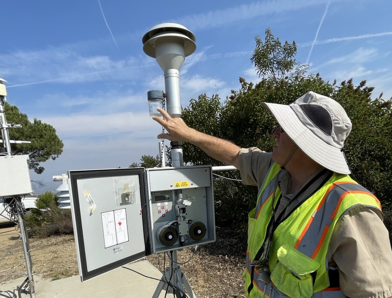
DOE began conducting perimeter air monitoring in April 2018 to establish the baseline conditions of air quality for use during remediation activities at SSFL.
Read about the air monitoring program at the Energy Technology Engineering Center (ETEC) in Area IV.
ETEC's previous air monitoring reports, as well as the air monitoring reports from the other areas of SSFL, can be accessed on DTSC’s SSFL document library under Air Monitoring.
Radiological environmental monitoring has been conducted at SSFL since the mid 1950s. The Annual Site Environmental Report (ASER) for DOE operations at SSFL describes environmental management performance for DOE activities such as environmental monitoring of effluents and estimated radiological doses to the public from radioactive materials, environmental occurrences and responses reported during the calendar year, compliance with environmental standards and requirements, and significant programs and efforts related to environmental management.
DOE will conduct a noise and traffic study in the near future as part of the ongoing effort to investigate, characterize, and move to cleanup for Area IV and the Northern Buffer Zone at SSFL. As DOE progresses towards cleanup, and in preparation for the necessary environmental reviews under the California Environmental Quality Act (CEQA) and the National Environmental Policy Act (NEPA), this study is necessary to understand traffic and noise in the surrounding communities and to plan for cleanup.
Read the Noise and Traffic Fact Sheet and Noise and Traffic Monitoring Plan for more information.
In December 2007, Boeing issued the Offsite Data Evaluation Report, Santa Susana Field Laboratory, Ventura County, California, that compiles the results of prior environmental sampling programs, including data from 18 field sampling and analysis programs. The report summarizes and evaluates the results of offsite media sampling and testing data for chemical and radiological contaminants collected by Boeing, NASA and DOE within a 15-mile radius around SSFL over a period of nearly 60 years.
Read Appendices A through D for details about the following:
- Appendix A - Searchable Offsite Program Document Database
- Appendix B - Offsite Sampling Results
- Part 1: Offsite Analytical Database
- Part 2: Offsite Analytical Results (Figures)
- Appendix C - Environmental Screening Level Basis
- Appendix D - Supplementary Groundwater Information
This was a milestone of the Consent Order for Corrective Action.
National Emission Standards for Hazardous Air Pollutants (NESHAPs) Reports for DOE facilities at SSFL from 1991 to present are provided here.