
Testing validates system accuracy, provides comprehensive picture of bird and bat activity
Wind has the potential to provide a clean, efficient source of energy that is harnessed off the nation’s coasts. The U.S. Department of Energy’s (DOE’s) Wind Energy Technologies Office (WETO) is advancing the development of technologies that will capture this abundant offshore wind while also showing a strong commitment to protecting wildlife, such as birds and bats that can fly into harm’s way.
To protect bird and bat species, wind energy researchers must gather data, such as flight height and patterns, passage rates, and flight speed. This behavioral information serves as a source for offshore wind plant developers to make decisions about where and how to locate wind turbines. Yet, obtaining these data from remote offshore locations is challenging—limited to ship-based and aerial surveys in daylight hours and fair weather.
Commissioned by WETO, the Pacific Northwest National Laboratory (PNNL) developed ThermalTracker-3D (formerly called ThermalTracker2) in 2017 to help overcome these challenges. This software solution, equipped with a pair of thermal cameras and stereovision processing and streaming, is remotely deployed to provide the 3D data needed to understand how bird and bat behaviors are affected by the presence of offshore wind turbines.
PNNL developers recently evaluated the accuracy of ThermalTracker-3D. In a research paper published earlier this year in Ecological Informatics, the team demonstrated capturing 3D flight tracks. They used an unmanned aerial system (a drone) equipped with a global positioning system (GPS) as the target, flying for 15–35 minutes at a time in straight and curving patterns between 50 meters and 325 meters from the ThermalTracker-3D system. The research took place at the National Renewable Energy Laboratory’s Flatirons Campus.
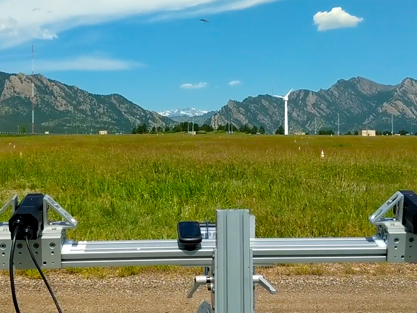
ThermalTracker-3D tracks an unmanned aerial system (visible top, center) during testing at the NREL Flatirons Campus. Photo by Shari Matzner, PNNL
“During the evaluation, we found that the tracking accuracy was within a few meters of the GPS, on average,” said Shari Matzner, the PNNL scientist who led the development of ThermalTracker-3D and subsequent testing. “This level of accuracy is comparable to that of human estimates of flight height noted in other studies.”
From this evaluation, the team determined that the 3D method has the potential to provide a more comprehensive picture, in real time, of all bird and bat activities around wind turbines than is possible with current survey methods.
The team has since adapted ThermalTracker-3D to collect baseline avian data at remote offshore wind locations and is planning to deploy the system on one of WETO’s lidar buoys off the California coast for an initial sea trial.
Fall 2020 R&D Newsletter
Explore previous editions of the Wind R&D Newsletter or browse articles by topic: