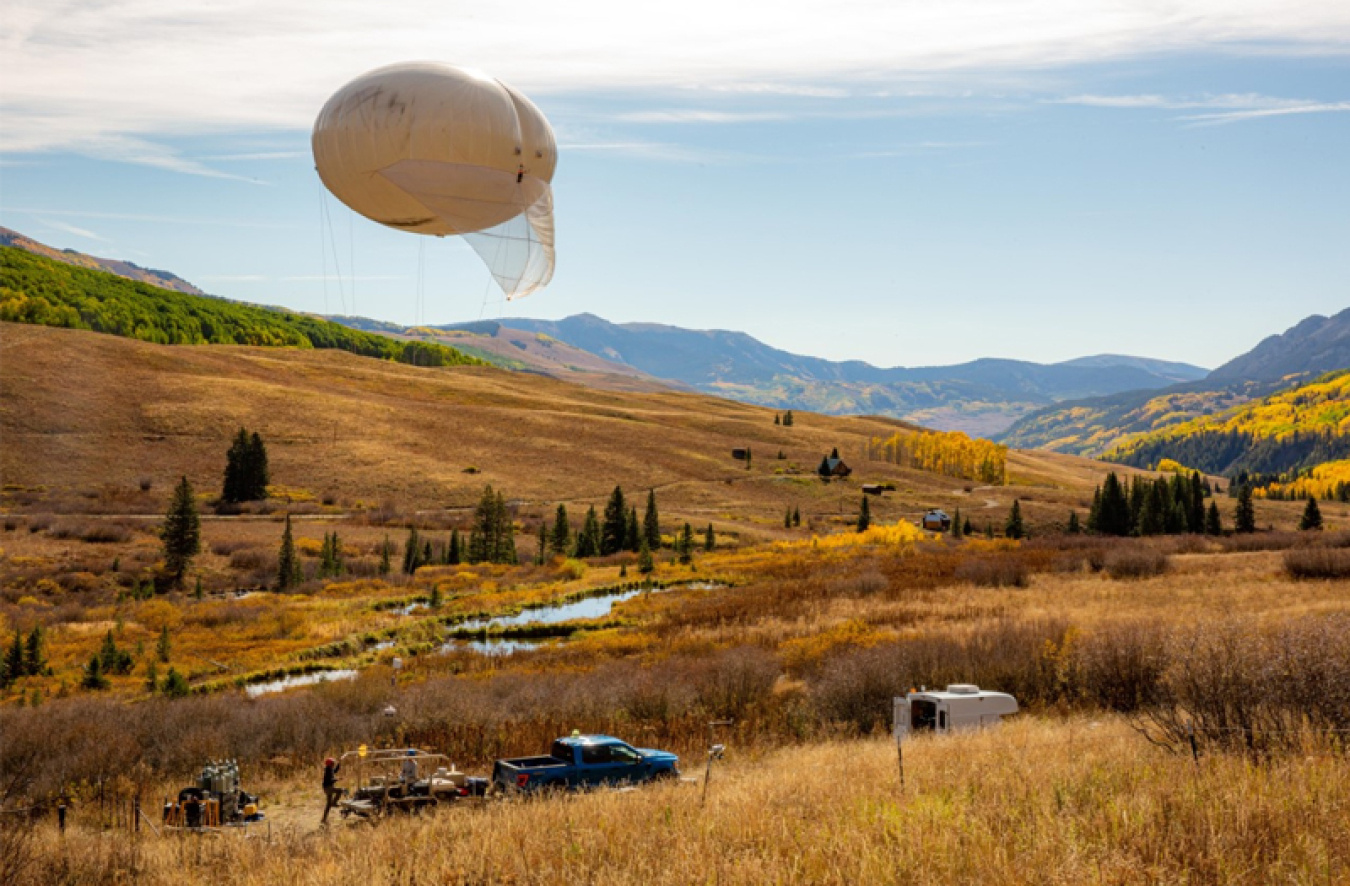
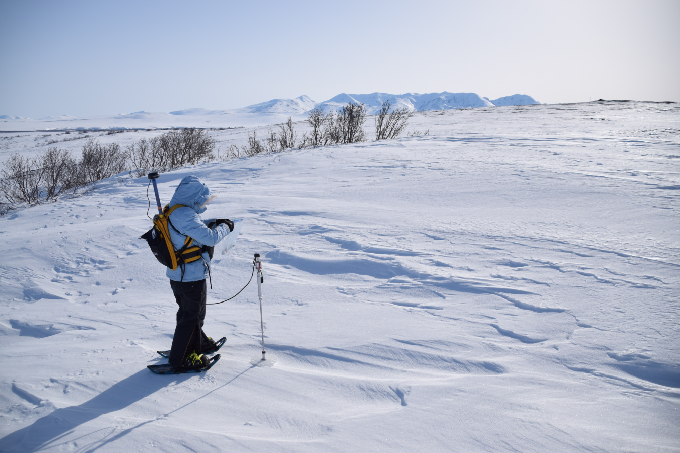
A researcher in the Alaskan tundra walks in snowshoes measuring snow depth with a probe that looks like a high-tech walking stick. In the boggy forests of Minnesota, a researcher measures carbon dioxide and methane in a plot of forest, enclosed and heated to simulate a warmer future. A tethered weather balloon for monitoring the water cycle is launched in the mountains of the Upper Colorado River Basin. These and other projects are supported by the U.S. Department of Energy Office of Science to better understand environmental change and improve Earth system and climate models.
The Office of Science is a world leader in the development of Earth system models with core strengths in climate and environmental sciences that take advantage of DOE’s scientific user facilities. Earth system models simulate the physical processes that affect climate and energy—including atmosphere, land, ice, and ocean interactions, as well as human activities like energy use and agriculture. As computers become more powerful and scientists learn more about Earth’s processes, we can develop new or refine existing models and also simulate the benefits of clean energy technologies. So, what does it take to build a good model? Here are four ways the Office of Science is advancing Earth system modeling.
1. We design Earth system models to perform on the world's fastest supercomputers.
The Office of Science is preparing to stand up the nation’s first exascale supercomputers, which will compute more than a quintillion (1018) calculations per second. These machines will enable scientists to model more complex systems with greater accuracy and solve new problems. Working with a famously complex system—the Earth itself—climate scientists have been preparing for exascale for years.
DOE’s Energy Exascale Earth System Model (E3SM) predicts changes to the atmosphere, land, ocean, and ice and simulates how human activities can drive or mitigate climate change. In particular, the model is designed to better simulate the energy and water cycles, including how extreme weather and water availability will change in the future. The model also mirrors nutrient cycles important to our world’s ecosystems and how ice melt is driving sea level rise. At exascale, E3SM will resolve finer details and run more variations of each scenario to boost predictability. Scientists are readying E3SM for exascale on current supercomputers and have already doubled the speed of the model since 2018.
Supercomputers are not only getting faster but they’re also getting smarter with hardware designed for both modeling and simulation, as well as artificial intelligence programs. Researchers supported by the Office of Science are using AI techniques to accelerate model performance and more rapidly improve accuracy of predictions through initiatives such as the Artificial Intelligence for Earth System Predictability.
2. We improve models by collecting new data.
To build a good model, we must start with good data. The Office of Science supports long-term field experiments involving the world’s most climate-sensitive ecosystems. Major DOE efforts are underway to study how clouds and aerosols impact climate. Field studies are tested with modeling to better understand the carbon cycle.
Since 2012, scientists with the Next-Generation Environmental Ecosystems–Arctic project have studied the role of carbon in Alaskan ecosystems—where icy soil known as permafrost serves as a vast carbon locker for the world. Scientists are monitoring environmental change, particularly in plants, as the permafrost thaws and releases its carbon stores.
Through its Atmospheric Radiation Measurement (ARM) user facility, the Office of Science supports stationary and mobile observatories outfitted to study science questions in different regions. For nearly 30 years, the Office of Science has sent mobile observatories around the globe, including the Arctic Ocean and the Amazon rainforest of central Brazil. As part of the Tracking Aerosol Convection Interactions Experiment (TRACER), ARM recently sent a mobile observatory to Houston, Texas. This experiment is studying how pollution influences clouds, aerosols, and rainfall across an urban region. Meanwhile, scientists are using another ARM observatory to measure patterns of clouds, storms, and the water cycle in the Rocky Mountains. The Surface Atmosphere Integrated Field Laboratory (SAIL) project will collect data to improve predictions of future water availability in the West.
Whether through mobile observatories on coasts and mountains, airplanes navigating atmospheric rivers in the sky, or drones mapping Arctic vegetation, researchers supported by the Office of Science are chasing new opportunities to improve Earth system models.
3. We simulate rising temperatures in field experiments and compare to models.
If we use observational data to test Earth system models, where do we get real-world data for climate scenarios that haven’t happened yet? We turn up the heat in field experiments like SPRUCE—Spruce and Peatland Responses Under Changing Environments. The SPRUCE warming experiment simulates climate change warming scenarios in the peatlands of northern Minnesota. Peatlands are wet bogs where plants cannot easily decompose and release carbon. Instead, the carbon is trapped in water-logged plant matter. While peatlands only cover three percent of the Earth’s surface, they store one-third of the world’s land-based carbon. SPRUCE consists of several pods where scientists warm the air and ground to simulate different future warming scenarios.
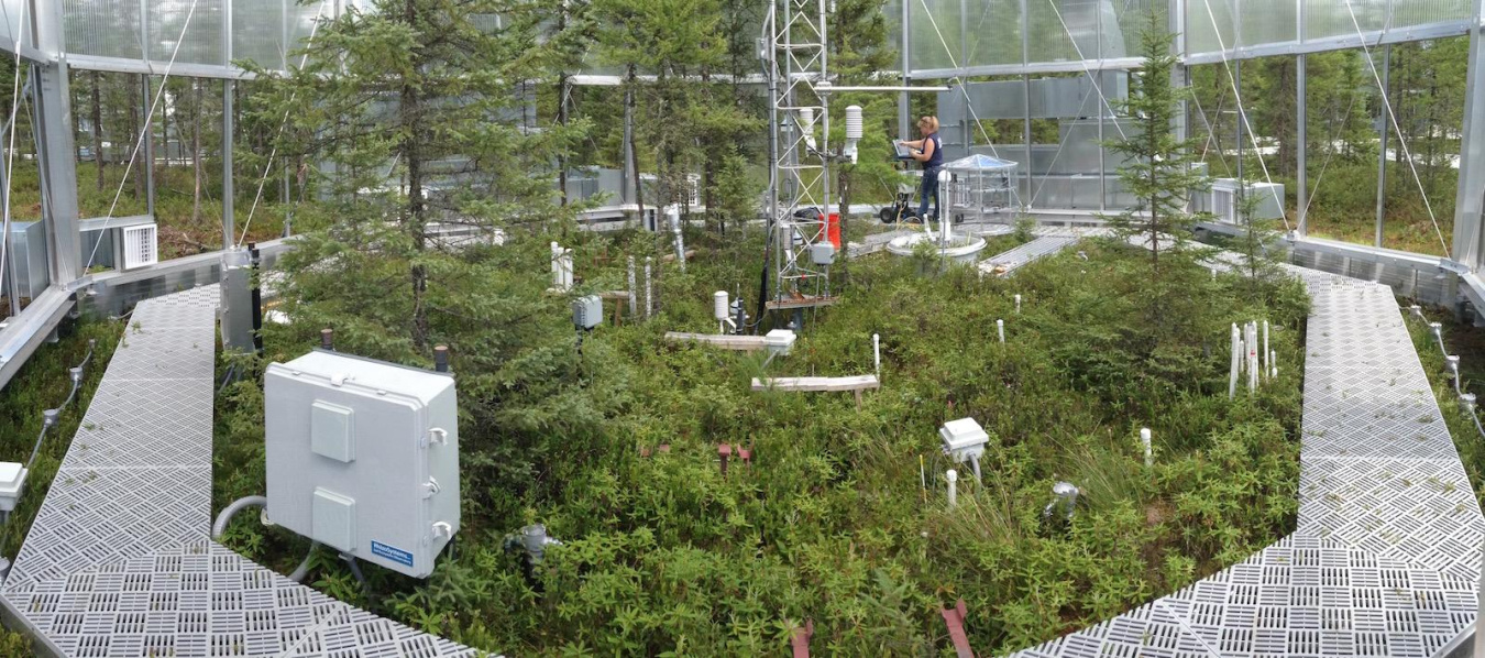
These scenarios range from 0 to up to 9 degrees Celsius (16 degrees Fahrenheit). Scientists then collect data on the response of plants, microbes, and the surrounding environment in each of the pods. Warming studies also extend to other ecosystems. The TRACE project in Puerto Rico explores the effects of warming on the tropics. The tropics cover one-fourth of the Earth’s surface and exchange the most carbon with the atmosphere.
4. We develop models with communities and decision-makers in mind.
Climate modeling projections can help decision-makers—such as city governments, energy providers, and home and business owners—prepare for the future. Researchers supported by the Office of Science-funded HyperFACETS project build case studies around extreme weather events with immense regional impacts. By using observational data to model conditions related to a key event, researchers can test how well models perform on a regional scale to improve predictive capabilities.
For example, one case study examined the 2018 California wildfires. At the time, they were the largest and deadliest wildfires on record. By analyzing the precipitation cycle around the event, researchers predicted the possibility that wetter winters and drier fall and summer seasons may prolong a wildfire season. Additional case studies include nor’easters, Atlantic Coast hurricanes, and other regional events strongly tied to global climate change.
Melting ice caps at the North and South Poles drive global sea level rise. That makes ice a vital component in climate models. With support from DOE’s Scientific Discovery through Advanced Computing program, researchers developed two complementary ice sheet models to incorporate into E3SM. Using these models, scientists explored how ice shelves disintegrate in the Antarctic. Using DOE supercomputers and E3SM, researchers also tracked the impacts of melting ice on Arctic coastlines, where warmer waters affect industries like shipping and fishing.
By advancing Earth system models with the world’s best scientific expertise and technology, we can help inform all levels of decision-makers—from homeowners to farmers to mayors to nations—about the potential future impacts of climate change.
The Office of Science is the single largest supporter of basic research in the physical sciences in the United States and is working to address some of the most pressing challenges of our time. For more information, please visit the Office of Science website.